
| Prel. Rep. | Date | Time(UTC) | Time(Local) | Lat. | Lon. | Depth | Mag. | Region | Waveform |
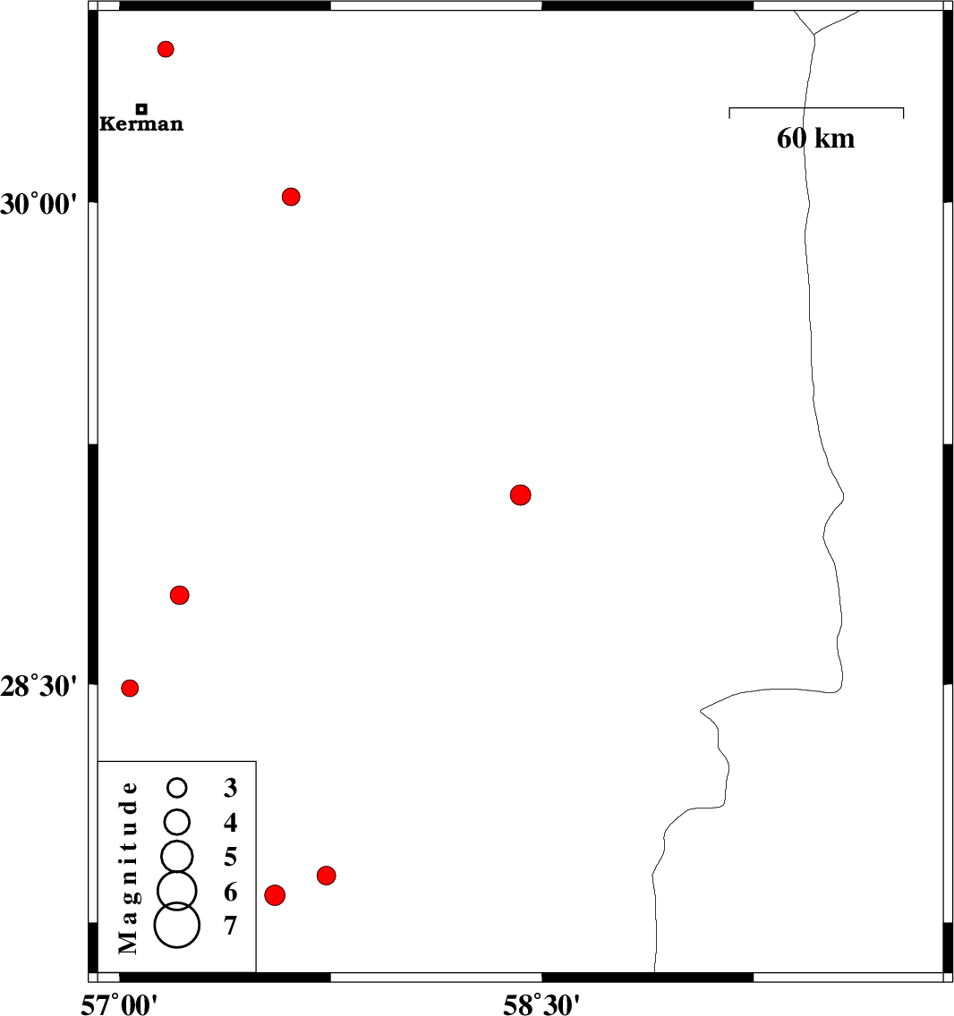
| 2019/02/18 | 14:54:01.5 | 18:24:01.5 | 29.091 | 58.423 | 14 | ML:3.2 | Kerman Province, 7 km of Bam | ||
| 2019/02/11 | 18:45:32.7 | 22:15:32.7 | 30.017 | 57.609 | 15 | ML:2.8 | Kerman Province, 59 km South-East of Kerman | ||
| 2019/02/05 | 20:53:01.9 | 00:23:01.9 | 28.778 | 57.213 | 15 | ML:2.9 | Kerman Province, 53 km North-West of Jiroft | ||
| 2019/02/03 | 12:48:46.0 | 16:18:46.0 | 27.898 | 57.735 | 18 | ML:2.9 | Kerman Province, 7 km of Kahnuj | ||
| 2019/01/28 | 15:08:18.8 | 18:38:18.8 | 28.487 | 57.037 | 14 | ML:2.7 | Kerman Province, 71 km South-West of Jiroft | ||
| 2019/01/24 | 04:55:54.4 | 08:25:54.4 | 27.835 | 57.551 | 14 | ML:3.3 | Kerman Province, 19 km South-West of Kahnuj | ||
| 2019/01/20 | 23:36:09.3 | 03:06:09.3 | 30.471 | 57.165 | 14 | ML:2.6 | Kerman Province, 22 km North of Kerman |

 IIEES All Rights Reserved