| Prel. Rep. | Date | Time(UTC) | Time(Local) | Lat. | Lon. | Depth | Mag. | Region | Waveform |
|
|
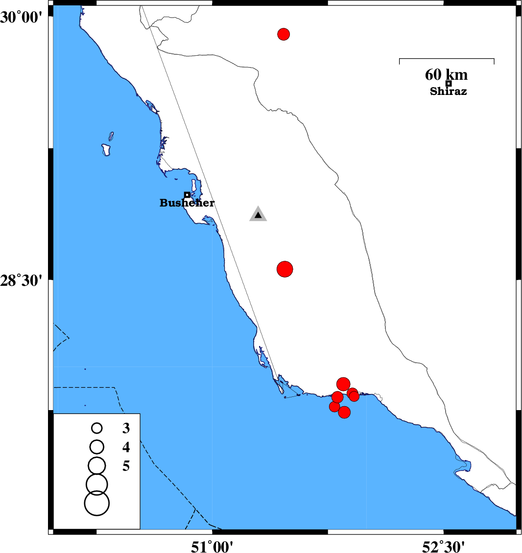
2019/03/30
|
22:44:24.9
|
03:14:24.9
| 28.56 | 51.47 | 25 |
ML:4.7
|
Bushehr Province, 14 km of Khormog | |
|
|
2019/03/09
|
03:44:16.4
|
07:14:16.4
| 29.897 | 51.462 | 15 |
ML:3.5
|
Fars Province, 25 km South of Nurabad | |
|
|
2019/03/06
|
08:08:37.2
|
11:38:37.2
| 27.825 | 51.812 | 14 |
ML:3.4
|
Persian Gulf, 24 km -West of Bandar-e kangan | |
|
|
2019/03/05
|
20:43:02.2
|
00:13:02.2
| 27.737 | 51.856 | 23 |
ML:3.5
|
Persian Gulf, 23 km -West of Bandar-e kangan | |
|
|
2019/03/02
|
05:56:50.9
|
09:26:50.9
| 27.9 | 51.85 | 31 |
ML:3.9
|
Bushehr Province, 22 km -West of Bandar-e kangan | |
|
|
2019/03/01
|
07:40:04.3
|
11:10:04.3
| 27.829 | 51.92 | 34 |
ML:2.9
|
Bushehr Province, 14 km -West of Bandar-e kangan | |
|
|
2019/03/01
|
07:20:06.9
|
10:50:06.9
| 27.846 | 51.908 | 37 |
ML:3.3
|
Bushehr Province, 15 km -West of Bandar-e kangan | |
|
|
2019/03/01
|
07:16:26.9
|
10:46:26.9
| 27.77 | 51.793 | 34 |
ML:3.1
|
Persian Gulf, 27 km -West of Bandar-e kangan | |