Home / Recent Earthquakes

| Prel. Rep. | Date | Time(UTC) | Time(Local) | Lat. | Lon. | Depth | Mag. | Region | Waveform |
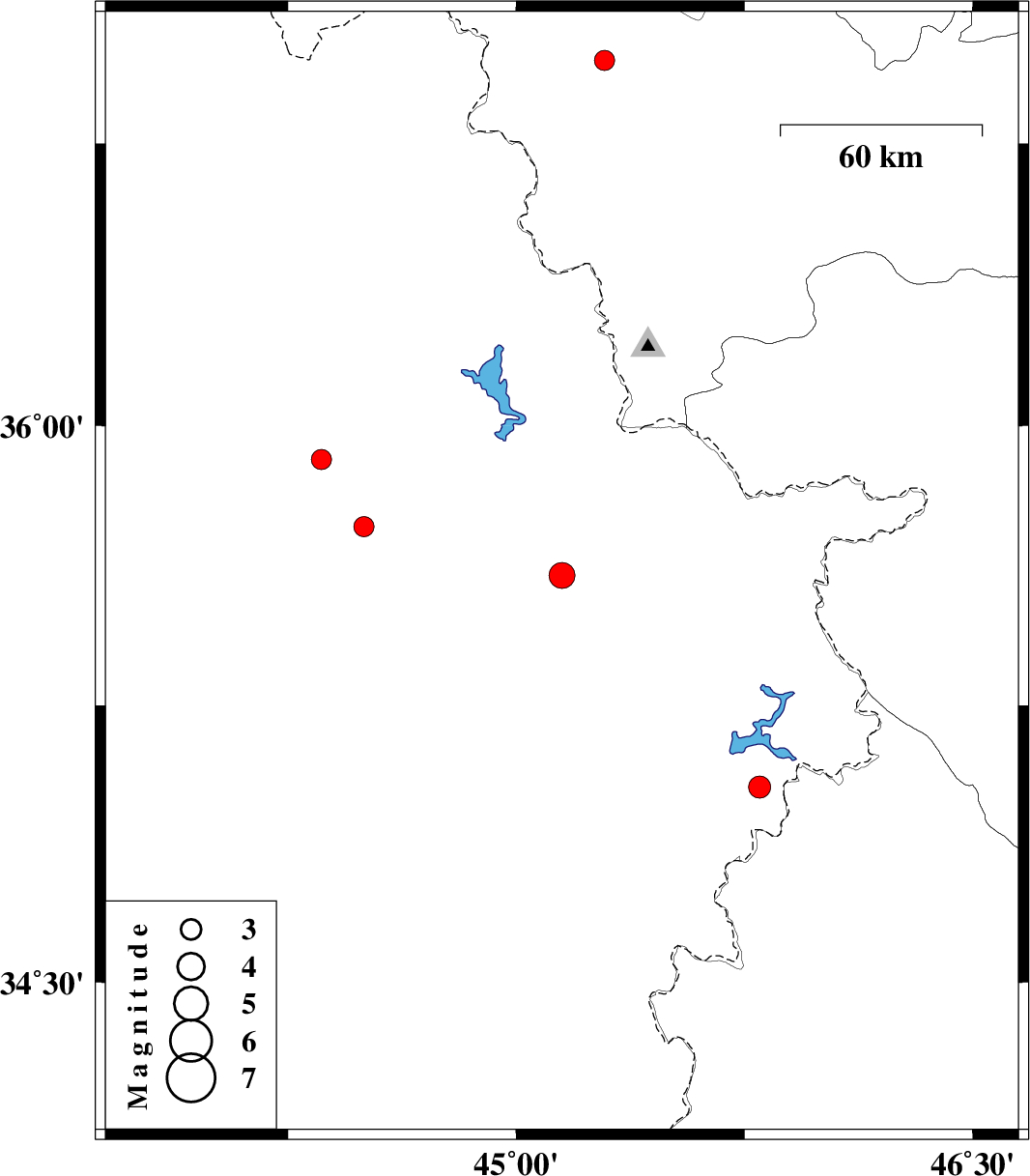
| 2021/01/10 | 23:00:46.9 | 02:30:46.9 | 35.6 | 45.15 | 10 | ML:3.8 | Iraq, 27 km -West of Sulaymaniyah | ||
| 2021/01/09 | 19:26:38.6 | 22:56:38.6 | 36.97 | 45.29 | 10 | ML:3 | Azarbaijan Gharbi Province, 8 km of Naqadeh | ||
| 2020/12/30 | 04:13:43.2 | 07:43:43.2 | 35.73 | 44.5 | 10 | ML:2.9 | Iraq, 87 km North-West of Sulaymaniyah | ||
| 2020/12/20 | 18:49:09.0 | 22:19:09.0 | 35.03 | 45.8 | 10 | ML:3.2 | Iraq, 30 km North of Tazehabad | ||
| 2020/12/18 | 14:48:56.6 | 18:18:56.6 | 35.91 | 44.36 | 10 | ML:2.9 | Iraq |