Home / Recent Earthquakes

| Prel. Rep. | Date | Time(UTC) | Time(Local) | Lat. | Lon. | Depth | Mag. | Region | Waveform |
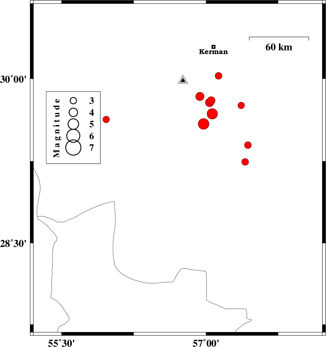
| 2021/03/15 | 15:40:21.2 | 19:10:21.2 | 29.178 | 56.708 | 12 | ML:3.5 | Kerman Province, 11 km of Baft | ||
| 2021/03/14 | 13:12:53.4 | 16:42:53.4 | 30.62 | 57.288 | 16 | ML:3.1 | Kerman Province, 42 km North-East of Kerman | ||
| 2021/03/14 | 12:54:07.6 | 16:24:07.6 | 28.138 | 56.933 | 10 | ML:4.9 | Hormozgan Province, 78 km North-West of Kahnuj | ||
| 2021/03/14 | 12:54:06.7 | 16:24:06.7 | 28.045 | 56.842 | 12 | ML:5.1 | Hormozgan Province, 84 km -West of Kahnuj | ||
| 2021/03/11 | 09:19:29.8 | 12:49:29.8 | 30.177 | 57.681 | 12 | ML:3.5 | Kerman Province, 59 km South-East of Kerman | ||
| 2021/03/04 | 03:47:57.2 | 07:17:57.2 | 27.695 | 57.274 | 10 | ML:3.3 | Hormozgan Province, 30 km North of Dehbarez | ||
| 2021/03/03 | 03:16:05.6 | 06:46:05.6 | 28.299 | 56.804 | 12 | ML:3.9 | Kerman Province, 88 km -East of Hajiabad | ||
| 2021/03/03 | 03:00:32.6 | 06:30:32.6 | 28.261 | 56.921 | 12 | ML:3.7 | Kerman Province, 100 km -East of Hajiabad | ||
| 2021/03/03 | 02:35:25.5 | 06:05:25.5 | 28.243 | 56.904 | 12 | ML:4 | Hormozgan Province, 98 km -East of Hajiabad | ||
| 2021/03/02 | 10:12:01.7 | 13:42:01.7 | 28.489 | 56.998 | 12 | ML:3.2 | Kerman Province, 75 km South-West of Jiroft | ||
| 2021/02/27 | 02:37:13.0 | 06:07:13.0 | 30.594 | 57.054 | 12 | ML:3.2 | Kerman Province, 34 km North of Kerman | ||
| 2021/02/24 | 00:15:59.5 | 03:45:59.5 | 27.849 | 57.302 | 22 | ML:3.3 | Hormozgan Province, 47 km North of Dehbarez | ||
| 2021/02/23 | 15:59:16.9 | 19:29:16.9 | 28.086 | 55.831 | 12 | ML:3.1 | Hormozgan Province, 26 km South of Hajiabad | ||
| 2021/02/22 | 22:35:21.0 | 02:05:21.0 | 28.216 | 57.233 | 10 | ML:3.1 | Kerman Province, 54 km North-West of Kahnuj |