
| Prel. Rep. | Date | Time(UTC) | Time(Local) | Lat. | Lon. | Depth | Mag. | Region | Waveform |
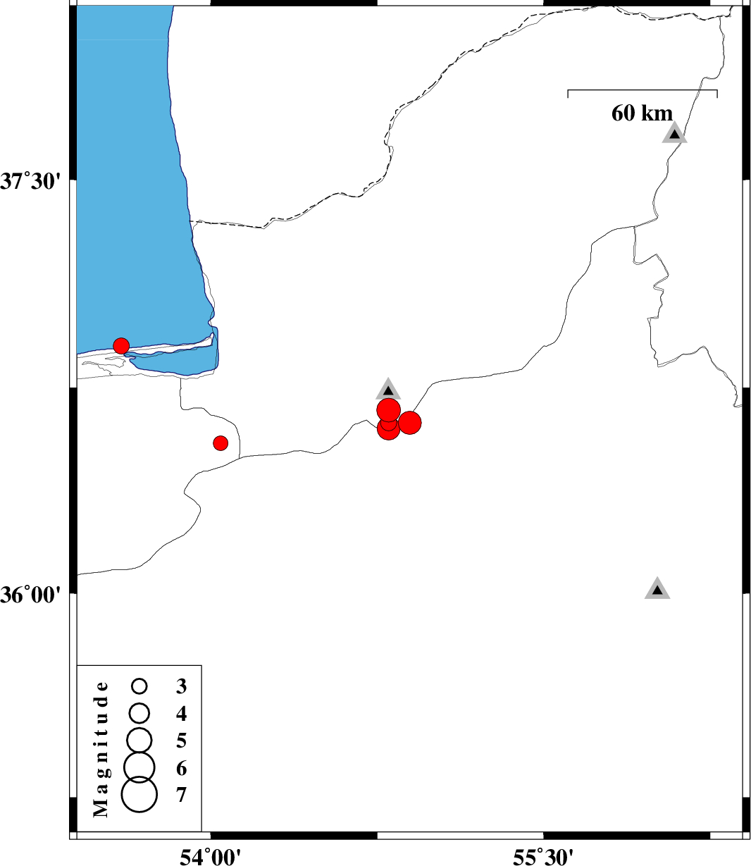
| 2025/07/18 | 04:46:31.2 | 08:16:31.2 | 36.622 | 54.896 | 12 | ML:4.7 | Semnan Province, 23 km North of Shahrud | ||
| 2025/07/15 | 07:14:56.1 | 10:44:56.1 | 36.668 | 54.801 | 7 | ML:4.8 | Golestan Province, 27 km South of Ali Abad | ||
| 2025/07/04 | 07:07:48.3 | 10:37:48.3 | 36.548 | 54.043 | 12 | ML:3 | Mazandaran Province, 28 km South of Kordkuy | ||
| 2025/06/27 | 14:15:02.1 | 17:45:02.1 | 36.622 | 54.801 | 12 | ML:3.3 | Golestan Province, 32 km South of Ali Abad | ||
| 2025/06/24 | 17:38:25.3 | 21:08:25.3 | 36.602 | 54.801 | 8 | ML:4.6 | Semnan Province, 25 km North-West of Shahrud | ||
| 2025/06/20 | 11:58:41.1 | 15:28:41.1 | 36.9 | 53.596 | 12 | ML:3.2 | Caspian Sea, 23 km North of Behshahr |

 IIEES All Rights Reserved