Home / Recent Earthquakes

| Prel. Rep. | Date | Time(UTC) | Time(Local) | Lat. | Lon. | Depth | Mag. | Region | Waveform |
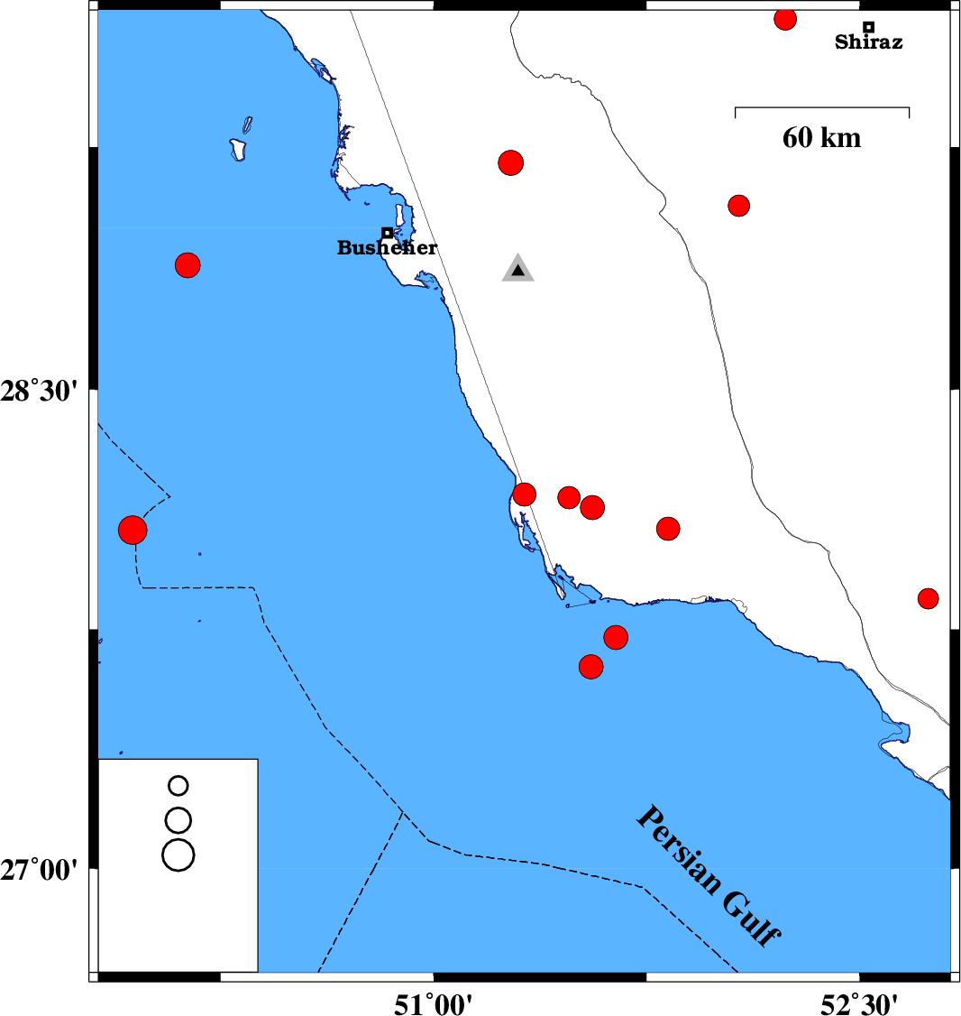
| 2025/12/01 | 19:57:09.0 | 23:27:09.0 | 28.132 | 51.559 | 22 | ML:3.8 | Bushehr Province, 61 km South-East of Khormog | ||
| 2025/12/01 | 15:11:45.6 | 18:41:45.6 | 28.172 | 51.319 | 12 | ML:3.7 | Bushehr Province, 54 km South of Khormog | ||
| 2025/12/01 | 12:28:43.3 | 15:58:43.3 | 28.162 | 51.477 | 12 | ML:3.5 | Bushehr Province, 55 km South-East of Khormog | ||
| 2025/11/18 | 15:46:32.1 | 19:16:32.1 | 28.061 | 49.939 | 12 | ML:4.5 | Persian Gulf | ||
| 2025/11/17 | 23:54:14.8 | 03:24:14.8 | 29.201 | 51.271 | 12 | ML:3.9 | Bushehr Province, 9 km of Borazjan | ||
| 2025/11/16 | 02:21:35.2 | 05:51:35.2 | 29.644 | 52.238 | 12 | ML:3.5 | Fars Province, 29 km -West of Shiraz | ||
| 2025/11/14 | 19:33:51.4 | 23:03:51.4 | 27.634 | 51.554 | 12 | ML:3.8 | Persian Gulf, 54 km South-West of Bandar-e kangan | ||
| 2025/11/14 | 15:22:15.4 | 18:52:15.4 | 27.725 | 51.641 | 20 | ML:3.8 | Persian Gulf, 43 km South-West of Bandar-e kangan | ||
| 2025/11/12 | 23:52:14.6 | 03:22:14.6 | 28.065 | 51.826 | 12 | ML:3.6 | Bushehr Province, 35 km North-West of Bandar-e kangan | ||
| 2025/11/10 | 12:22:09.6 | 15:52:09.6 | 28.884 | 50.133 | 12 | ML:3.9 | Persian Gulf, 69 km South-West of Busheher | ||
| 2025/11/09 | 03:22:16.4 | 06:52:16.4 | 29.069 | 52.075 | 10 | ML:3.4 | Fars Province, 22 km North of Farashband | ||
| 2025/11/04 | 18:10:58.7 | 21:40:58.7 | 27.846 | 52.741 | 12 | ML:3.3 | Fars Province, 42 km -East of Jam |