Home / Recent Earthquakes

| Prel. Rep. | Date | Time(UTC) | Time(Local) | Lat. | Lon. | Depth | Mag. | Region | Waveform |
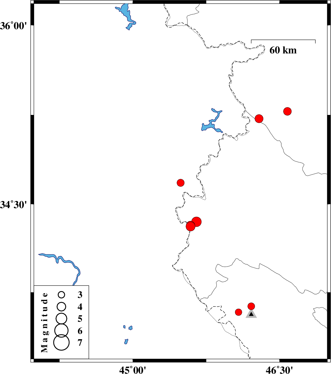
| 2020/07/12 | 11:14:01.6 | 15:44:01.6 | 34.679 | 45.488 | 8 | ML:3.4 | Iraq, 20 km North of Qasr-E-Shirin | ||
| 2020/07/08 | 07:10:39.3 | 11:40:39.3 | 34.31 | 45.59 | 14 | ML:4.2 | Kermanshah Province, 23 km South of Qasr-E-Shirin | ||
| 2020/07/07 | 13:10:23.8 | 17:40:23.8 | 34.32 | 45.59 | 14 | ML:4 | Kermanshah Province, 22 km South of Qasr-E-Shirin | ||
| 2020/07/07 | 08:52:26.6 | 13:22:26.6 | 34.35 | 45.65 | 12 | ML:4.5 | Kermanshah Province, 19 km South of Qasr-E-Shirin | ||
| 2020/07/04 | 12:06:39.2 | 16:36:39.2 | 33.58 | 46.08 | 10 | ML:3.1 | Ilam Province, 33 km -West of Ilam | ||
| 2020/06/26 | 01:14:31.0 | 05:44:31.0 | 35.22 | 46.29 | 10 | ML:3.8 | Kurdistan Province, 19 km North of Paveh | ||
| 2020/06/19 | 15:13:31.1 | 19:43:31.1 | 33.63 | 46.21 | 10 | ML:3.3 | Ilam Province, 20 km -West of Ilam | ||
| 2020/06/18 | 19:42:40.4 | 00:12:40.4 | 35.28 | 46.58 | 10 | ML:3.7 | Kurdistan Province, 32 km North-East of Paveh |