Home / Recent Earthquakes

| Prel. Rep. | Date | Time(UTC) | Time(Local) | Lat. | Lon. | Depth | Mag. | Region | Waveform |
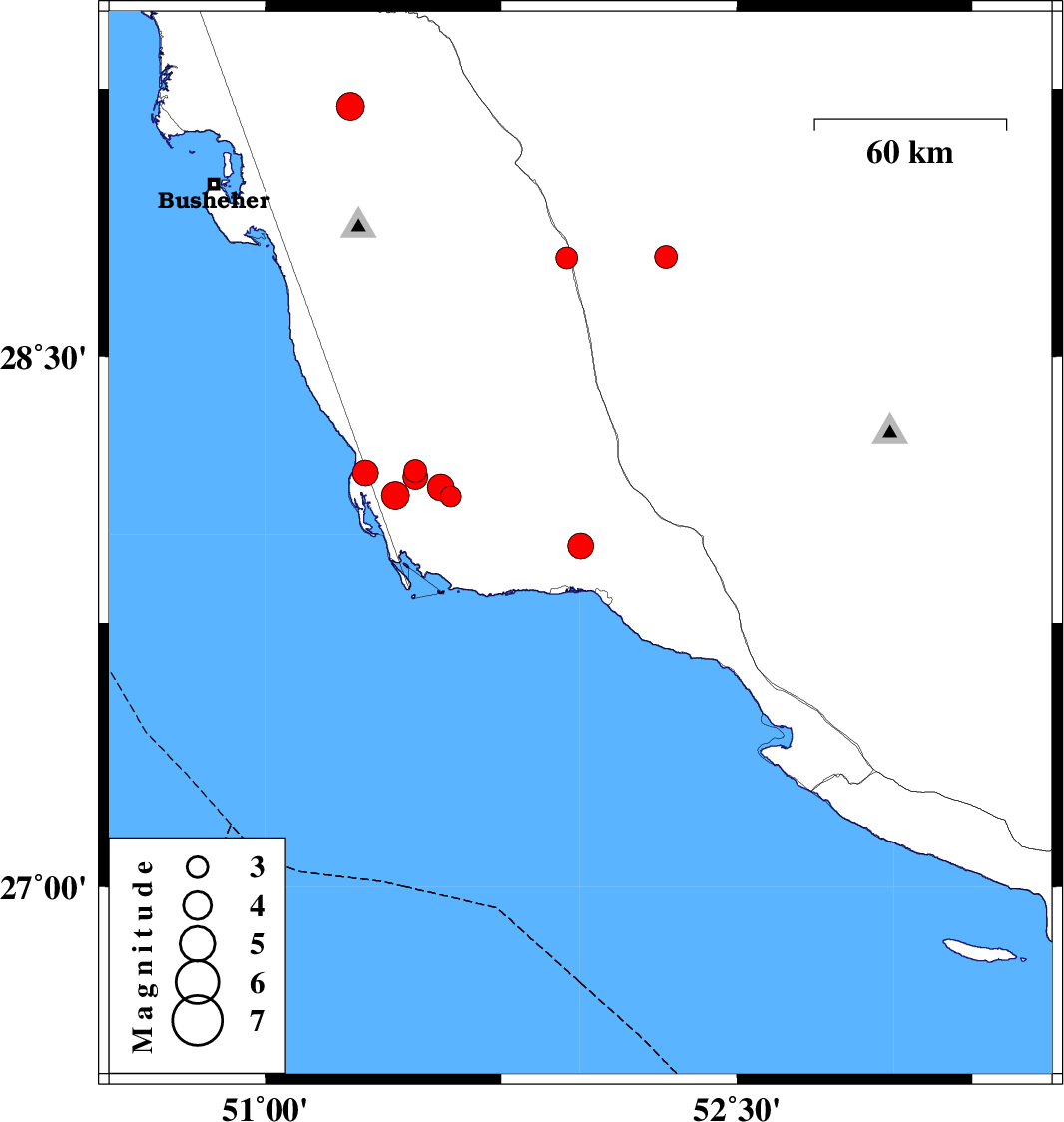
| 2025/12/16 | 23:55:52.2 | 03:25:52.2 | 27.967 | 52.003 | 29 | ML:3.6 | Bushehr Province, 17 km North of Bandar-e kangan | ||
| 2025/12/14 | 20:55:55.5 | 00:25:55.5 | 28.779 | 51.958 | 12 | ML:3.1 | Bushehr Province, 16 km -West of Farashband | ||
| 2025/12/09 | 14:49:15.5 | 18:19:15.5 | 28.782 | 52.274 | 12 | ML:3.2 | Fars Province, 21 km -East of Farashband | ||
| 2025/12/03 | 00:20:25.4 | 03:50:25.4 | 28.178 | 51.477 | 12 | ML:3.3 | Bushehr Province, 54 km South-East of Khormog | ||
| 2025/12/02 | 22:29:16.8 | 01:59:16.8 | 28.107 | 51.591 | 12 | ML:3 | Bushehr Province, 56 km North-West of Bandar-e kangan | ||
| 2025/12/02 | 13:30:00.6 | 17:00:00.6 | 28.11 | 51.414 | 12 | ML:4 | Bushehr Province, 60 km South of Khormog | ||
| 2025/12/01 | 19:57:09.0 | 23:27:09.0 | 28.132 | 51.559 | 22 | ML:3.8 | Bushehr Province, 61 km South-East of Khormog | ||
| 2025/12/01 | 15:11:45.6 | 18:41:45.6 | 28.172 | 51.319 | 12 | ML:3.7 | Bushehr Province, 54 km South of Khormog | ||
| 2025/12/01 | 12:28:43.3 | 15:58:43.3 | 28.162 | 51.477 | 12 | ML:3.5 | Bushehr Province, 55 km South-East of Khormog | ||
| 2025/11/17 | 23:54:14.8 | 03:24:14.8 | 29.201 | 51.271 | 12 | ML:3.9 | Bushehr Province, 9 km of Borazjan |