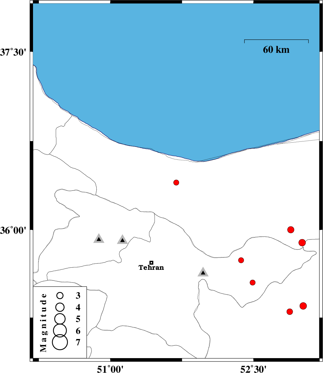
| Prel. Rep. | Date | Time(UTC) | Time(Local) | Lat. | Lon. | Depth | Mag. | Region | Waveform |
|
|
2007/05/01
|
22:57:26.7
|
02:27:26.7
| 36.4 | 51.69 | 27 |
ML:2.5
|
32 km South-East of Nowshahr, Mazandaran Province | |
|
|
2007/04/29
|
05:36:09.7
|
09:06:09.7
| 35.74 | 52.37 | 6 |
ML:2.6
|
27 km East of Damavand, Tehran Province | |
|
|
2007/04/27
|
00:46:59.8
|
04:16:59.8
| 35.55 | 52.49 | 15 |
ML:2.6
|
33 km South-West of Firuzkuh, Tehran Province | |
|
|
2007/04/24
|
03:33:16.5
|
07:03:16.5
| 36 | 52.89 | 15 |
ML:3.1
|
19 km South-West of Pol-E-Sefid, Mazandaran Province | |
|
|
2007/04/17
|
19:13:43.3
|
22:43:43.3
| 35.35 | 53.02 | 15 |
ML:3.2
|
42 km South-West of Semnan, Semnan Province | |
|
|
2007/04/05
|
19:50:55.6
|
23:20:55.6
| 35.3 | 52.88 | 16 |
ML:2.8
|
49 km East of Garmsar, Semnan Province | |
|
|
2007/04/03
|
22:27:37.3
|
01:57:37.3
| 35.89 | 53.01 | 17 |
ML:3.2
|
24 km South of Pol-E-Sefid, Mazandaran Province | |