| Prel. Rep. | Date | Time(UTC) | Time(Local) | Lat. | Lon. | Depth | Mag. | Region | Waveform |
|
|
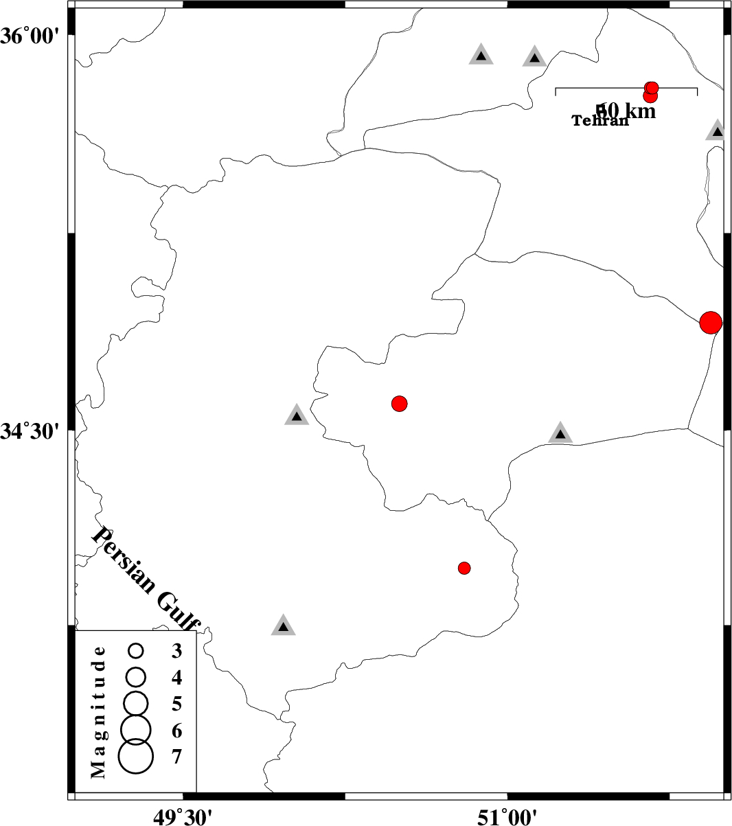
2007/08/29
|
11:25:06.8
|
14:55:06.8
| 34.6 | 50.5 | 14 |
ML:3.2
|
33 km West of Qom, Qom Province | |
|
|
2007/08/28
|
08:08:10.6
|
11:38:10.6
| 33.97 | 50.8 | 16 |
ML:2.6
|
11 km East of Delijan, Markazi Province | |
|
|
2007/08/27
|
03:49:33.3
|
07:19:33.3
| 33.7 | 49.03 | 44 |
ML:2.8
|
24 km North of Dorud, Lorestan Province | |
|
|
2007/08/25
|
10:07:35.3
|
13:37:35.3
| 34.91 | 51.94 | 24 |
ML:4.6
|
50 km South-West of Garmsar, Semnan Province | |
|
|
2007/07/31
|
07:09:43.4
|
10:39:43.4
| 35.8 | 51.67 | 14 |
ML:2.6
|
19 km East of Tajrish, Tehran Province | |
|
|
2007/07/31
|
03:18:26.4
|
06:48:26.4
| 35.8 | 51.66 | 15 |
ML:2.5
|
19 km East of Tajrish, Tehran Province | |
|
|
2007/07/31
|
03:07:59.8
|
06:37:59.8
| 35.77 | 51.66 | 16 |
ML:2.9
|
19 km East of Tajrish, Tehran Province | |