| Prel. Rep. | Date | Time(UTC) | Time(Local) | Lat. | Lon. | Depth | Mag. | Region | Waveform |
|
|
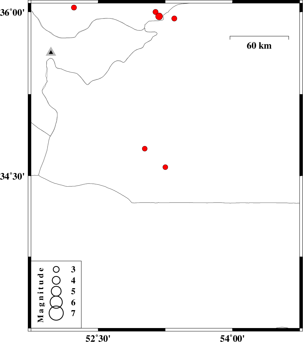
2008/02/11
|
00:40:06.3
|
04:10:06.3
| 34.58 | 53.25 | 14 |
ML:2.5
|
108 km South-East of Garmsar, Semnan Province | |
|
|
2008/02/10
|
15:03:55.5
|
18:33:55.5
| 36.04 | 52.23 | 15 |
ML:2.7
|
38 km North-East of Damavand, Tehran Province | |
|
|
2008/02/02
|
12:13:29.2
|
15:43:29.2
| 34.75 | 53.02 | 18 |
ML:2.5
|
81 km South-East of Garmsar, Semnan Province | |
|
|
2008/01/14
|
14:05:52.6
|
17:35:52.6
| 35.94 | 53.35 | 15 |
ML:2.7
|
32 km South-East of Pol-E-Sefid, Mazandaran Province | |
|
|
2008/01/14
|
07:54:02.2
|
11:24:02.2
| 35.96 | 53.18 | 16 |
ML:3.5
|
20 km South-East of Pol-E-Sefid, Mazandaran Province | |
|
|
2008/01/14
|
07:52:34.9
|
11:22:34.9
| 36 | 53.14 | 16 |
ML:2.7
|
15 km South of Pol-E-Sefid, Mazandaran Province | |