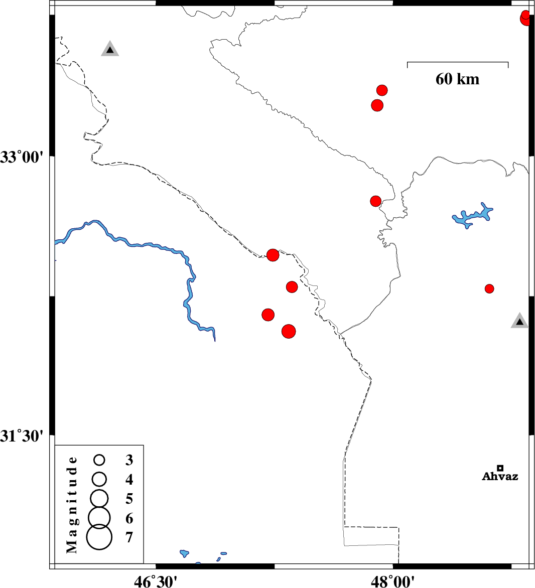
| Prel. Rep. | Date | Time(UTC) | Time(Local) | Lat. | Lon. | Depth | Mag. | Region | Waveform |
|
|
2008/11/26
|
12:44:22.4
|
16:14:22.4
| 32.3 | 47.36 | 14 |
ML:3.2
|
45 km South of Dehloran, Ilam Province | |
|
|
2008/11/23
|
06:59:52.3
|
10:29:52.3
| 33.27 | 47.9 | 37 |
ML:3.4
|
21 km North-East of Pol-e dokhtar, Lorestan Province | |
|
|
2008/11/23
|
03:28:30.5
|
06:58:30.5
| 33.35 | 47.93 | 18 |
ML:3.1
|
29 km North-East of Pol-e dokhtar, Lorestan Province | |
|
|
2008/11/22
|
17:50:46.5
|
21:20:46.5
| 32.06 | 47.34 | 39 |
ML:4
|
71 km South of Dehloran, Ilam Province | |
|
|
2008/11/13
|
19:07:54.5
|
22:37:54.5
| 32.15 | 47.21 | 39 |
ML:3.5
|
60 km South of Dehloran, Ilam Province | |
|
|
2008/11/10
|
14:26:35.2
|
17:56:35.2
| 32.47 | 47.24 | 41 |
ML:3.5
|
24 km South of Dehloran, Ilam Province | |
|
|
2008/11/07
|
08:39:25.2
|
12:09:25.2
| 32.76 | 47.89 | 14 |
ML:3.1
|
44 km South-East of Abdanan, Ilam Province | |
|
|
2008/10/30
|
20:15:54.6
|
23:45:54.6
| 32.29 | 48.61 | 36 |
ML:2.6
|
22 km East of Dezful, Khoozestan Province | |
|
|
2008/10/29
|
17:43:22.5
|
21:13:22.5
| 33.75 | 48.84 | 15 |
ML:2.6
|
18 km South of Borujerd, Lorestan Province | |
|
|
2008/10/29
|
10:30:00.4
|
14:00:00.4
| 33.73 | 48.85 | 14 |
ML:4.1
|
20 km South of Borujerd, Lorestan Province | |