| Prel. Rep. | Date | Time(UTC) | Time(Local) | Lat. | Lon. | Depth | Mag. | Region | Waveform |
|
|
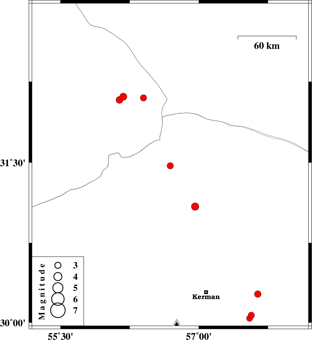
2010/03/04
|
16:21:22.7
|
19:51:22.7
| 32.1 | 56.4 | 14 |
ML:3.1
|
Yazd Province, 101 km North-West of Ravar | |
|
|
2010/03/04
|
15:39:56.3
|
19:09:56.3
| 31.47 | 56.69 | 38 |
ML:3.1
|
Kerman Province, 26 km North-West of Ravar | |
|
|
2010/03/04
|
01:13:29.5
|
04:43:29.5
| 32.11 | 56.18 | 14 |
ML:3.5
|
Yazd Province, 93 km North-East of Bafq | |
|
|
2010/03/01
|
21:17:30.7
|
00:47:30.7
| 31.09 | 56.96 | 15 |
ML:3.6
|
Kerman Province, 24 km South-East of Ravar | |
|
|
2010/02/25
|
04:34:49.3
|
08:04:49.3
| 32.08 | 56.14 | 14 |
ML:3.4
|
Yazd Province, 88 km North-East of Bafq | |
|
|
2010/02/07
|
08:15:03.3
|
11:45:03.3
| 30.07 | 57.57 | 6 |
ML:3.1
|
53 km South-East of Kerman, Kerman Province | |
|
|
2010/02/07
|
08:13:04.4
|
11:43:04.4
| 30.27 | 57.64 | 15 |
ML:3.2
|
53 km East of Kerman, Kerman Province | |
|
|
2010/02/07
|
07:55:01.0
|
11:25:01.0
| 30.04 | 57.55 | 6 |
ML:3
|
52 km South-East of Kerman, Kerman Province | |