| Prel. Rep. | Date | Time(UTC) | Time(Local) | Lat. | Lon. | Depth | Mag. | Region | Waveform |
|
|
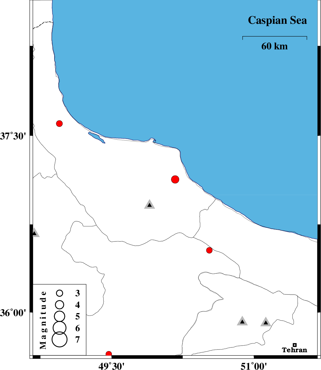
2010/04/08
|
09:25:12.4
|
13:55:12.4
| 37.13 | 50.17 | 17 |
ML:3.7
|
Gilan Province, 5 km Amlash | |
|
|
2010/04/06
|
16:04:34.5
|
20:34:34.5
| 35.75 | 49 | 18 |
ML:3
|
Ghazvin Province, 41 km North of Razan | |
|
|
2010/03/31
|
10:37:24.6
|
15:07:24.6
| 35.64 | 49.47 | 14 |
ML:2.8
|
Ghazvin Province, 52 km South-West of Takestan | |
|
|
2010/03/27
|
05:34:50.2
|
10:04:50.2
| 36.53 | 50.53 | 14 |
ML:2.8
|
Ghazvin Province, 43 km South-West of Ramsar | |
|
|
2010/03/19
|
14:17:30.3
|
17:47:30.3
| 35.66 | 48.91 | 33 |
ML:3.5
|
Hamedan Province, 33 km North-West of Razan | |
|
|
2010/03/10
|
18:02:12.7
|
21:32:12.7
| 37.6 | 48.95 | 14 |
ML:2.9
|
Gilan Province, 18 km West of Rezvanshahr | |