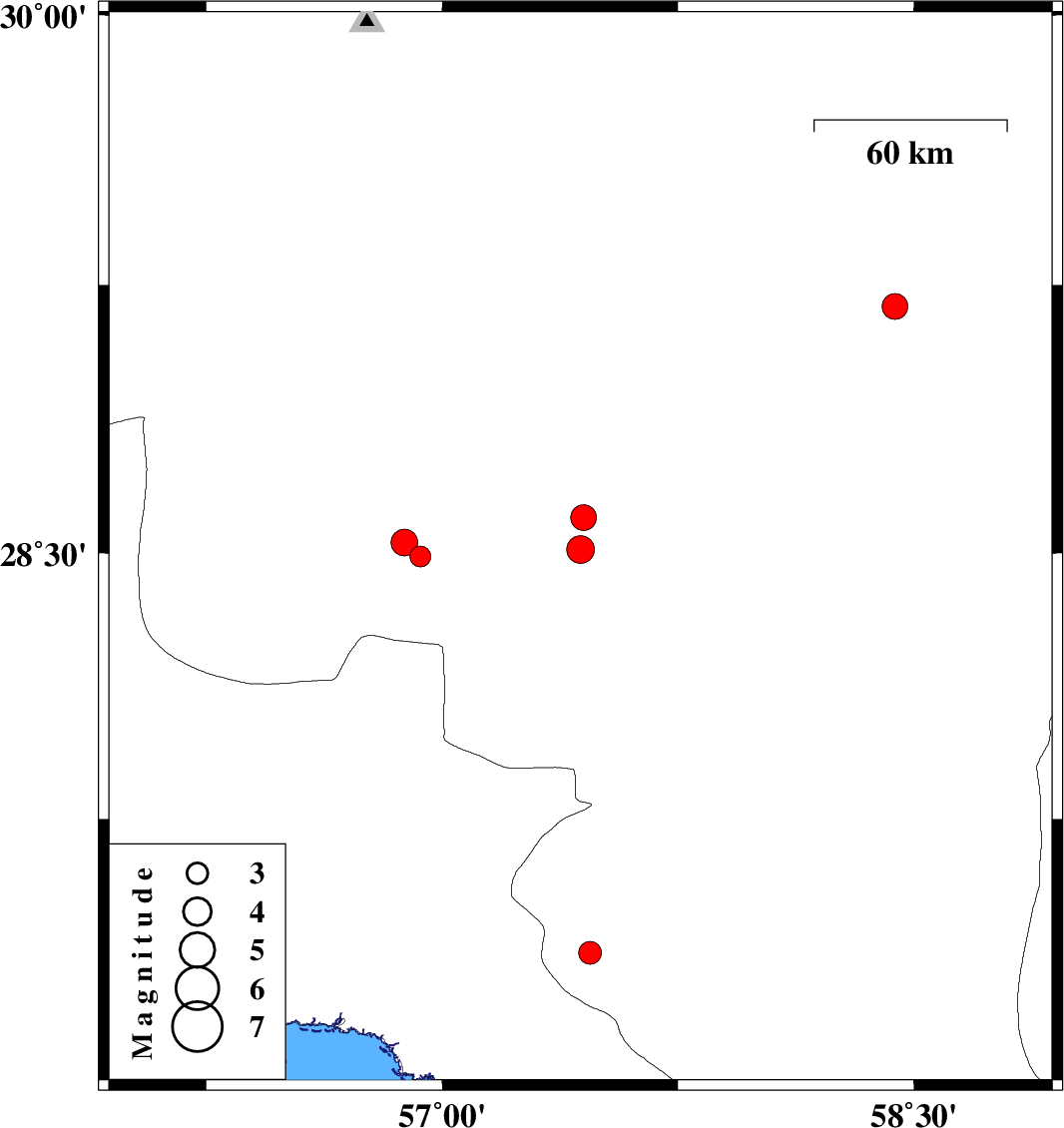
| Prel. Rep. | Date | Time(UTC) | Time(Local) | Lat. | Lon. | Depth | Mag. | Region | Waveform |
|
|
2010/04/29
|
21:14:02.2
|
01:44:02.2
| 28.51 | 57.44 | 39 |
ML:3.9
|
Kerman Province, 34 km South-West of Jiroft | |
|
|
2010/04/29
|
21:13:20.6
|
01:43:20.6
| 28.6 | 57.45 | 17 |
ML:3.6
|
Kerman Province, 30 km West of Jiroft | |
|
|
2010/04/28
|
21:31:46.0
|
02:01:46.0
| 27.28 | 56.16 | 6 |
ML:3.1
|
Hormozgan Province, 16 km West of Bandar-e abbas | |
|
|
2010/04/20
|
13:51:36.3
|
18:21:36.3
| 27.37 | 57.47 | 14 |
ML:3.2
|
Kerman Province, 5 km Manujan | |
|
|
2010/04/14
|
17:12:47.6
|
21:42:47.6
| 28.49 | 56.93 | 10 |
ML:2.9
|
Kerman Province, 82 km South-West of Jiroft | |
|
|
2010/04/11
|
13:49:13.3
|
18:19:13.3
| 28.53 | 56.88 | 14 |
ML:3.8
|
Kerman Province, 83 km South-East of Baft | |
|
|
2010/04/10
|
23:49:58.9
|
04:19:58.9
| 29.19 | 58.44 | 14 |
ML:3.7
|
Kerman Province, 12 km Bam | |
|
|
2010/04/10
|
21:26:03.0
|
01:56:03.0
| 27.59 | 56.3 | 14 |
ML:3.4
|
Hormozgan Province, 45 km North of Bandar-e abbas | |