Home / Recent Earthquakes

| Prel. Rep. | Date | Time(UTC) | Time(Local) | Lat. | Lon. | Depth | Mag. | Region | Waveform |
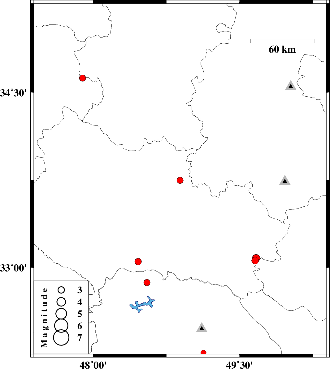
| 2010/09/09 | 02:30:18.5 | 07:00:18.5 | 33.75 | 48.89 | 6 | ML:2.9 | Lorestan Province, 21 km South-East of Borujerd | ||
| 2010/08/24 | 12:50:24.4 | 17:20:24.4 | 33.05 | 48.46 | 14 | ML:3.1 | Lorestan Province, 49 km South of Khorramabad | ||
| 2010/08/21 | 01:50:30.1 | 06:20:30.1 | 32.26 | 49.13 | 14 | ML:2.5 | Khoozestan Province, 14 km South of Lali | ||
| 2010/08/20 | 11:13:05.3 | 15:43:05.3 | 33.06 | 49.66 | 15 | ML:3.3 | Lorestan Province, 39 km South of Aligudarz | ||
| 2010/08/20 | 10:57:30.4 | 15:27:30.4 | 33.08 | 49.67 | 15 | ML:3.5 | Lorestan Province, 36 km South of Aligudarz | ||
| 2010/08/13 | 22:48:37.0 | 03:18:37.0 | 34.62 | 47.89 | 14 | ML:2.9 | Kermanshah Province, 15 km North of Kangavar | ||
| 2010/08/10 | 14:40:49.5 | 19:10:49.5 | 32.87 | 48.55 | 14 | ML:2.9 | Khoozestan Province, 49 km North-East of Andimeshk |