| Prel. Rep. | Date | Time(UTC) | Time(Local) | Lat. | Lon. | Depth | Mag. | Region | Waveform |
|
|
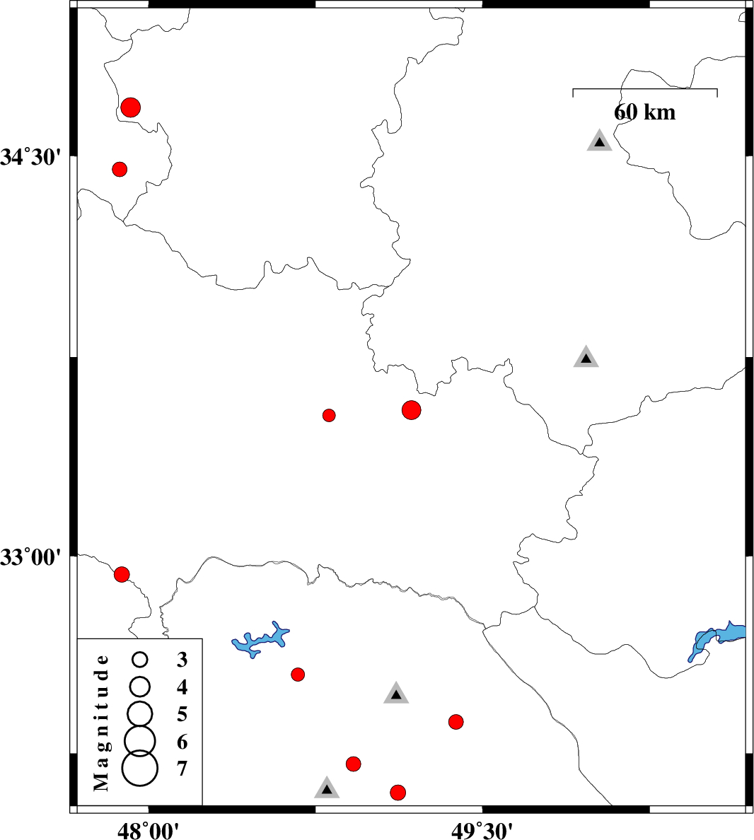
2011/03/22
|
07:07:57.4
|
11:37:57.4
| 33.55 | 49.18 | 16 |
ML:3.8
|
Lorestan Province, 13 km East of Dorud | |
|
|
2011/03/06
|
05:09:45.9
|
08:39:45.9
| 33.53 | 48.81 | 35 |
ML:2.6
|
Lorestan Province, 25 km West of Dorud | |
|
|
2011/03/03
|
12:38:02.2
|
16:08:02.2
| 32.55 | 48.67 | 16 |
ML:2.7
|
Khoozestan Province, 32 km East of Andimeshk | |
|
|
2011/03/01
|
12:06:49.5
|
15:36:49.5
| 32.93 | 47.88 | 15 |
ML:3.1
|
Ilam Province, 29 km South-East of Pol-e dokhtar | |
|
|
2011/02/27
|
13:18:25.7
|
16:48:25.7
| 34.68 | 47.92 | 42 |
ML:4
|
Hamedan Province, 21 km North of Kangavar | |
|
|
2011/02/24
|
06:48:18.3
|
10:18:18.3
| 32.1 | 49.12 | 14 |
ML:3.1
|
Khoozestan Province, 33 km South of Lali | |
|
|
2011/02/24
|
06:16:51.2
|
09:46:51.2
| 32.21 | 48.92 | 26 |
ML:3
|
Khoozestan Province, 19 km North of Shushtar | |
|
|
2011/02/23
|
20:58:36.0
|
00:28:36.0
| 34.45 | 47.87 | 18 |
ML:3
|
Kermanshah Province, 9 km Kangavar | |
|
|
2011/02/23
|
15:25:31.4
|
18:55:31.4
| 32.37 | 49.38 | 15 |
ML:2.9
|
Khoozestan Province, 25 km East of Lali | |