| Prel. Rep. | Date | Time(UTC) | Time(Local) | Lat. | Lon. | Depth | Mag. | Region | Waveform |
|
|
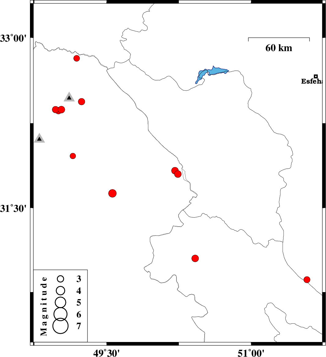
2011/04/22
|
19:41:42.7
|
00:11:42.7
| 31.8 | 50.24 | 28 |
ML:3.3
|
Khoozestan Province, 35 km East of Izeh | |
|
|
2011/04/19
|
15:43:13.6
|
20:13:13.6
| 31.63 | 49.56 | 14 |
ML:3.7
|
Khoozestan Province, 39 km North of Ramhormoz | |
|
|
2011/04/09
|
23:47:40.1
|
04:17:40.1
| 31.05 | 50.42 | 14 |
ML:3.2
|
Kohkiluieh va boyerahmad Province, 32 km North-West of Dehdasht | |
|
|
2011/04/09
|
02:43:50.1
|
07:13:50.1
| 30.86 | 51.58 | 15 |
ML:3
|
Esfahan Province, 12 km East of Sisakht | |
|
|
2011/04/05
|
06:40:59.9
|
11:10:59.9
| 32.37 | 49.03 | 14 |
ML:3.3
|
Khoozestan Province, 7 km Lali | |
|
|
2011/04/05
|
06:33:27.7
|
11:03:27.7
| 32.37 | 48.97 | 16 |
ML:3.1
|
Khoozestan Province, 13 km West of Lali | |
|
|
2011/04/05
|
06:31:56.2
|
11:01:56.2
| 32.36 | 49 | 15 |
ML:3.1
|
Khoozestan Province, 11 km West of Lali | |
|
|
2011/04/03
|
11:54:25.3
|
16:24:25.3
| 32.82 | 49.19 | 40 |
ML:2.8
|
Khoozestan Province, 48 km North of Lali | |
|
|
2011/03/28
|
18:22:54.0
|
22:52:54.0
| 32.44 | 49.24 | 14 |
ML:3.1
|
Khoozestan Province, 14 km East of Lali | |
|
|
2011/03/27
|
01:08:59.0
|
05:38:59.0
| 31.83 | 50.21 | 14 |
ML:3.2
|
Khoozestan Province, 32 km East of Izeh | |
|
|
2011/03/26
|
19:59:55.3
|
00:29:55.3
| 31.96 | 49.15 | 14 |
ML:2.7
|
Khoozestan Province, 14 km West of Masjed Soleyman | |