| Prel. Rep. | Date | Time(UTC) | Time(Local) | Lat. | Lon. | Depth | Mag. | Region | Waveform |
|
|
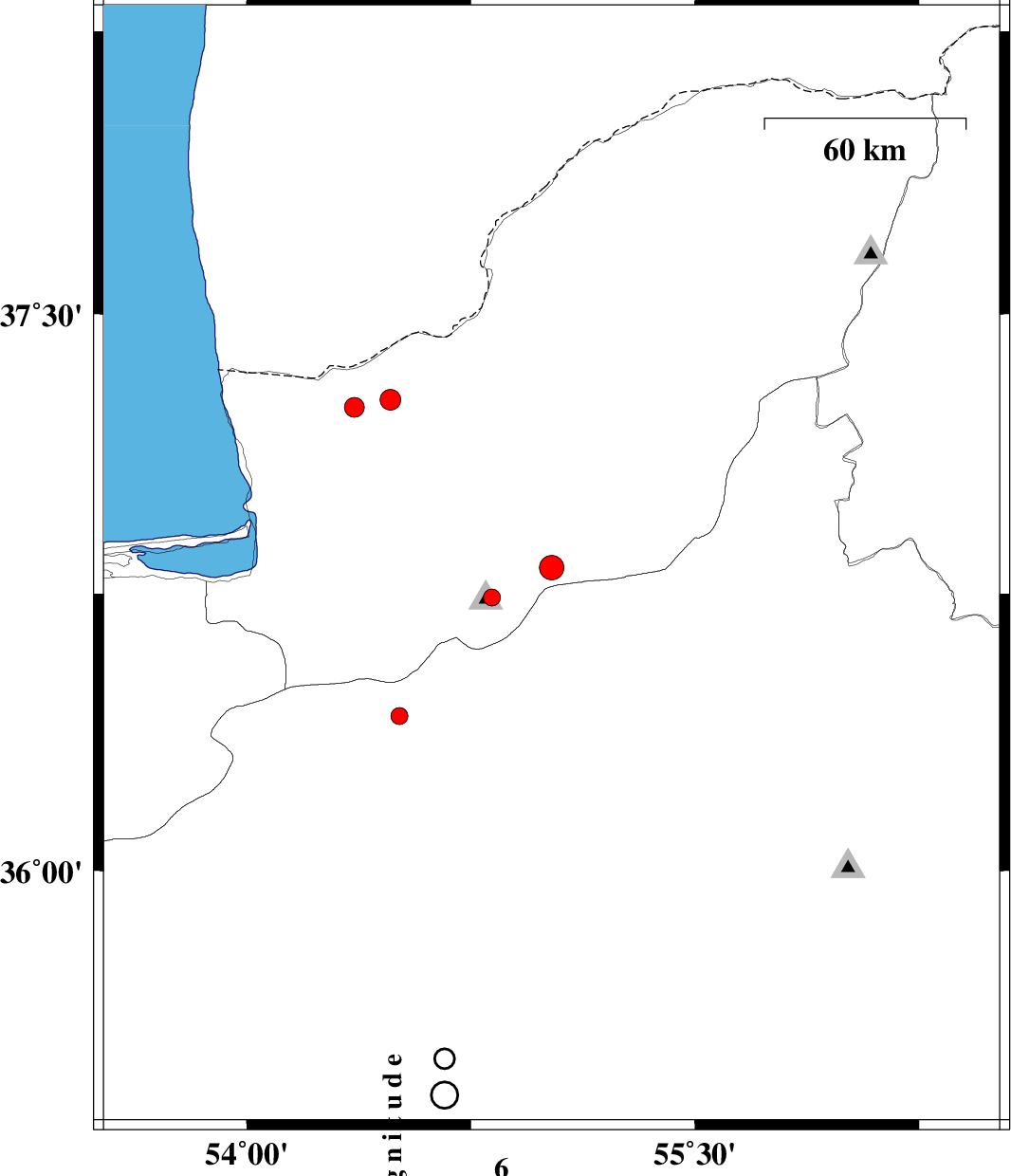
2012/09/08
|
13:08:02.2
|
17:38:02.2
| 36.82 | 55.02 | 14 |
ML:3.6
|
Golestan Province, 16 km East of Ali Abad | |
|
|
2012/09/07
|
04:45:11.3
|
09:15:11.3
| 36.42 | 54.51 | 15 |
ML:2.5
|
Semnan Province, 32 km North-East of Damghan | |
|
|
2012/09/04
|
00:18:59.4
|
04:48:59.4
| 37.27 | 54.48 | 26 |
ML:3.1
|
Golestan Province, 29 km North of Aq Qaleh | |
|
|
2012/09/03
|
21:26:43.6
|
01:56:43.6
| 37.25 | 54.36 | 18 |
ML:3
|
Golestan Province, 28 km North of Aq Qaleh | |
|
|
2012/08/29
|
23:46:21.5
|
04:16:21.5
| 36.74 | 54.82 | 15 |
ML:2.5
|
Golestan Province, 18 km South of Ali Abad | |
|
|
2012/08/17
|
20:02:08.6
|
00:32:08.6
| 36.82 | 55.01 | 14 |
ML:2.7
|
Golestan Province, 16 km East of Ali Abad | |