Home / Recent Earthquakes

| Prel. Rep. | Date | Time(UTC) | Time(Local) | Lat. | Lon. | Depth | Mag. | Region | Waveform |
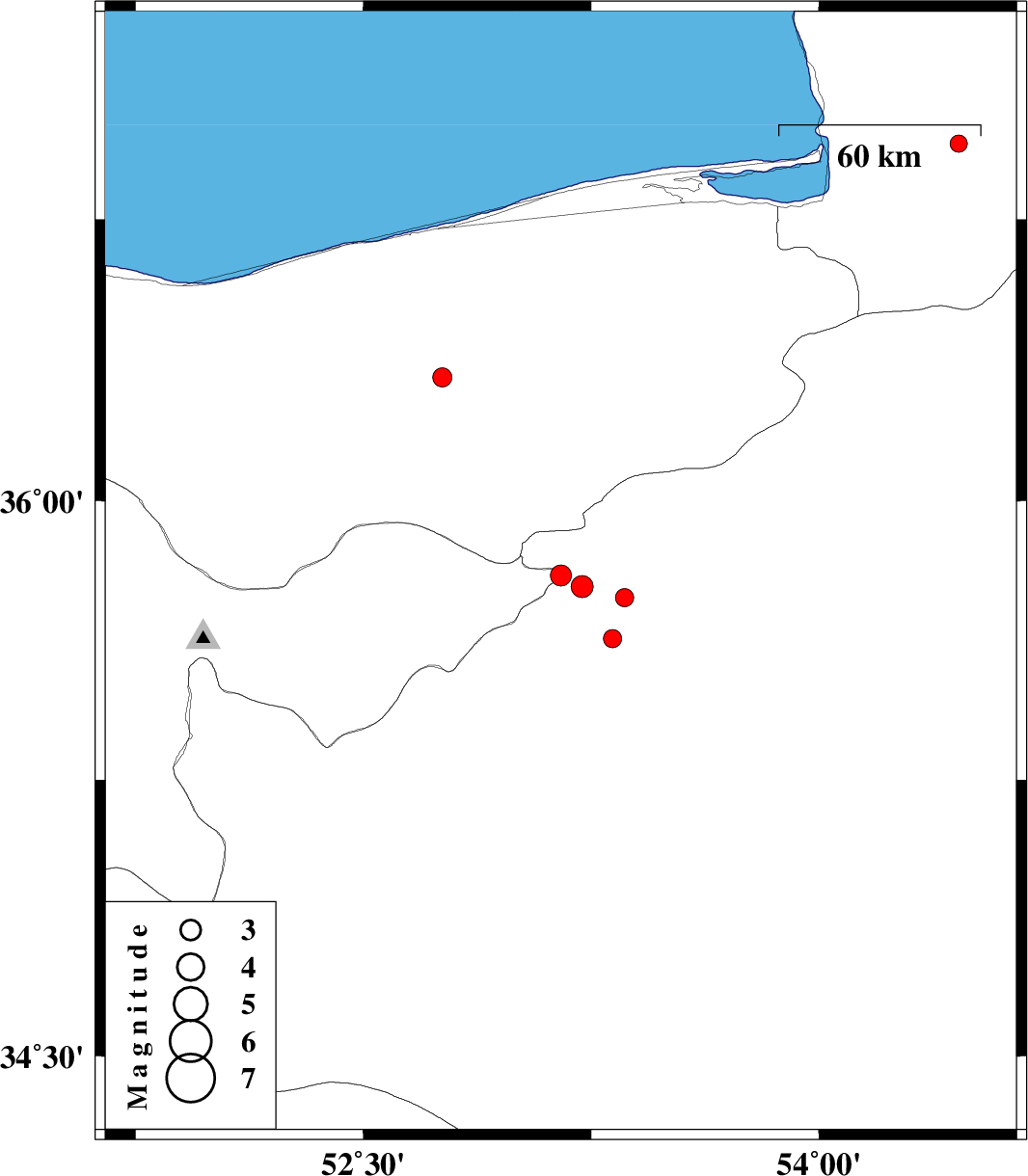
| 2012/11/30 | 07:34:30.0 | 11:04:30.0 | 35.63 | 53.32 | 14 | ML:2.7 | Semnan Province, 10 km Semnan | ||
| 2012/11/30 | 04:40:11.3 | 08:10:11.3 | 35.77 | 53.22 | 14 | ML:3.3 | Semnan Province, 28 km North-West of Semnan | ||
| 2012/11/30 | 01:04:54.0 | 04:34:54.0 | 35.8 | 53.15 | 24 | ML:3.1 | Tehran Province, 36 km South of Pol-E-Sefid | ||
| 2012/11/29 | 20:26:41.3 | 23:56:41.3 | 35.74 | 53.36 | 15 | ML:2.7 | Semnan Province, 19 km North of Semnan | ||
| 2012/11/28 | 19:58:11.6 | 23:28:11.6 | 36.95 | 54.46 | 15 | ML:2.6 | Golestan Province, 7 km Aq Qaleh | ||
| 2012/11/28 | 12:22:36.7 | 15:52:36.7 | 36.33 | 52.76 | 46 | ML:2.8 | Mazandaran Province, 17 km South-West of Qaemshahr |