Home / Recent Earthquakes

| Prel. Rep. | Date | Time(UTC) | Time(Local) | Lat. | Lon. | Depth | Mag. | Region | Waveform |
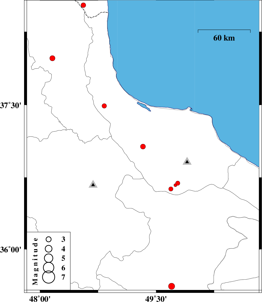
| 2012/12/01 | 12:23:28.6 | 15:53:28.6 | 37.07 | 49.33 | 14 | ML:3 | Gilan Province, 18 km South of Fuman | ||
| 2012/11/25 | 17:47:37.8 | 21:17:37.8 | 35.61 | 49.7 | 14 | ML:3.7 | Ghazvin Province, 50 km South of Takestan | ||
| 2012/11/19 | 17:32:43.6 | 21:02:43.6 | 36.69 | 49.78 | 14 | ML:2.5 | Gilan Province, 35 km South-East of Rudbar | ||
| 2012/11/18 | 02:16:45.8 | 05:46:45.8 | 36.67 | 49.75 | 30 | ML:1.9 | Gilan Province, 33 km South-East of Rudbar | ||
| 2012/11/16 | 22:25:30.6 | 01:55:30.6 | 36.63 | 49.69 | 14 | ML:2.5 | Gilan Province, 32 km South-East of Rudbar | ||
| 2012/11/08 | 02:02:35.2 | 05:32:35.2 | 38.52 | 48.56 | 14 | ML:2.8 | Azerbaijan, 12 km East of Namin | ||
| 2012/11/04 | 17:20:04.9 | 20:50:04.9 | 37.98 | 48.16 | 14 | ML:3.1 | Ardebil Province, 11 km Nir | ||
| 2012/11/04 | 05:36:48.1 | 09:06:48.1 | 37.49 | 48.83 | 16 | ML:2.7 | Gilan Province, 29 km West of Rezvanshahr |