| Prel. Rep. | Date | Time(UTC) | Time(Local) | Lat. | Lon. | Depth | Mag. | Region | Waveform |
|
|
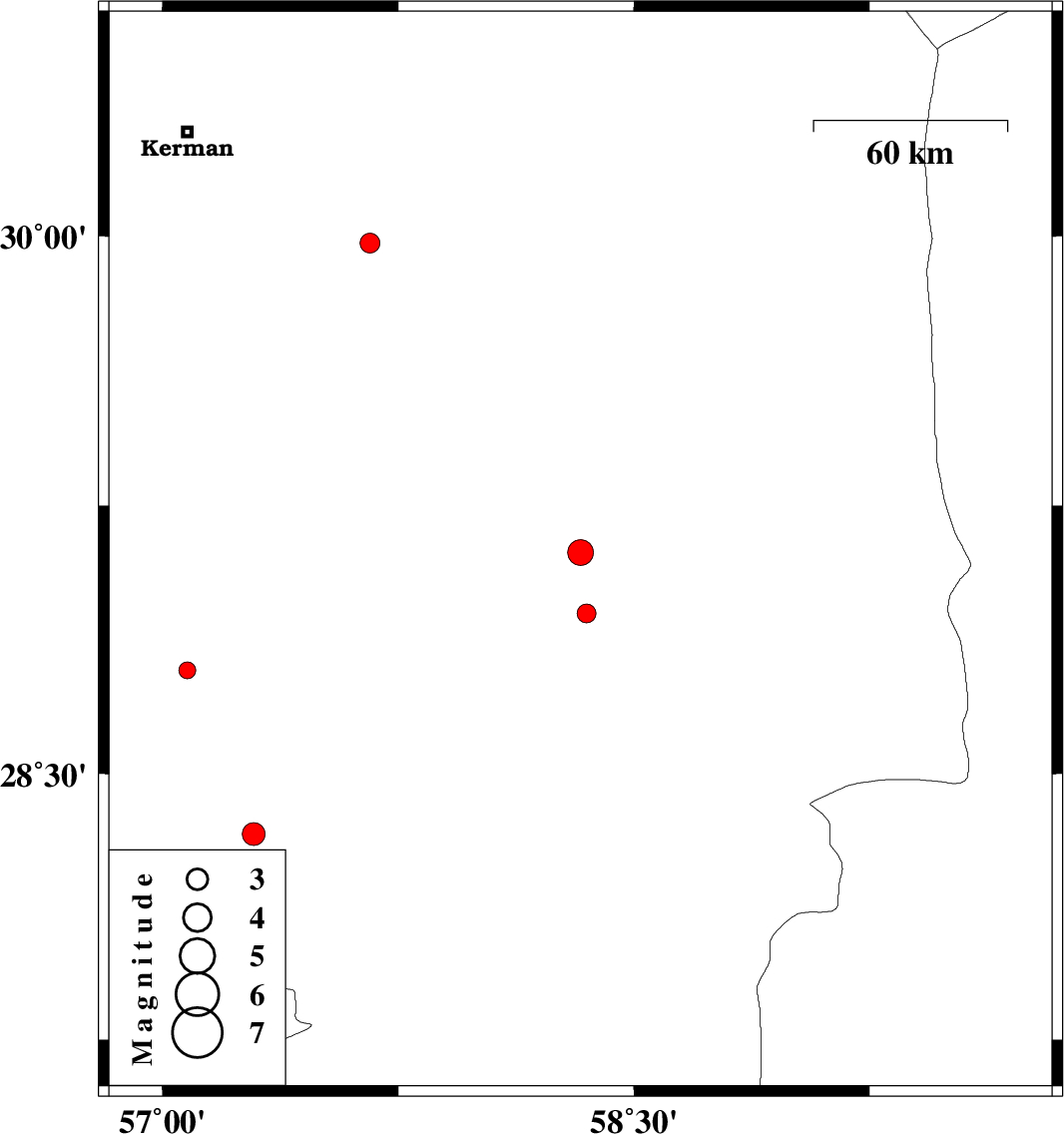
2013/06/17
|
03:57:00.3
|
08:27:00.3
| 29.12 | 58.33 | 15 |
ML:3.7
|
Kerman Province, 3 km Bam | |
|
|
2013/06/08
|
22:32:24.3
|
03:02:24.3
| 28.79 | 57.08 | 15 |
ML:2.4
|
Kerman Province, 66 km North-West of Jiroft | |
|
|
2013/06/06
|
16:37:18.9
|
21:07:18.9
| 29.98 | 57.66 | 14 |
ML:2.8
|
Kerman Province, 66 km South-East of Kerman | |
|
|
2013/06/03
|
07:36:57.6
|
12:06:57.6
| 28.33 | 57.29 | 30 |
ML:3.3
|
Kerman Province, 57 km South-West of Jiroft | |
|
|
2013/06/01
|
02:02:27.7
|
06:32:27.7
| 28.95 | 58.35 | 14 |
ML:2.7
|
Kerman Province, 18 km South of Bam | |
|
|
2013/05/21
|
18:30:00.2
|
23:00:00.2
| 28.04 | 57.28 | 14 |
ML:3.3
|
Kerman Province, 42 km West of Kahnuj | |