Home / Recent Earthquakes

| Prel. Rep. | Date | Time(UTC) | Time(Local) | Lat. | Lon. | Depth | Mag. | Region | Waveform |
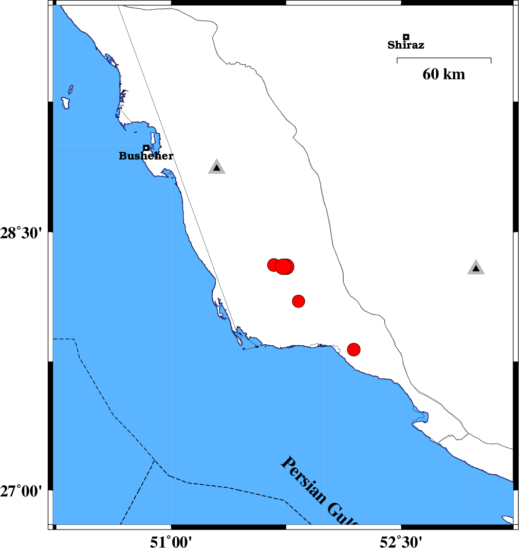
| 2013/08/10 | 17:20:46.1 | 21:50:46.1 | 28.3 | 51.73 | 15 | ML:4.6 | Bushehr Province, 53 km South-East of Khormog | ||
| 2013/08/10 | 17:05:33.7 | 21:35:33.7 | 28.3 | 51.75 | 15 | ML:4.7 | Bushehr Province, 54 km South-East of Khormog | ||
| 2013/08/04 | 03:53:47.8 | 08:23:47.8 | 28.1 | 51.83 | 32 | ML:3.6 | Bushehr Province, 38 km North-West of Bandar-e kangan | ||
| 2013/08/03 | 17:39:46.7 | 22:09:46.7 | 28.31 | 51.67 | 36 | ML:3.8 | Bushehr Province, 48 km South-East of Khormog | ||
| 2013/08/03 | 13:21:36.6 | 17:51:36.6 | 27.82 | 52.19 | 35 | ML:3.8 | Bushehr Province, 13 km East of Bandar-e kangan |