Home / Recent Earthquakes

| Prel. Rep. | Date | Time(UTC) | Time(Local) | Lat. | Lon. | Depth | Mag. | Region | Waveform |
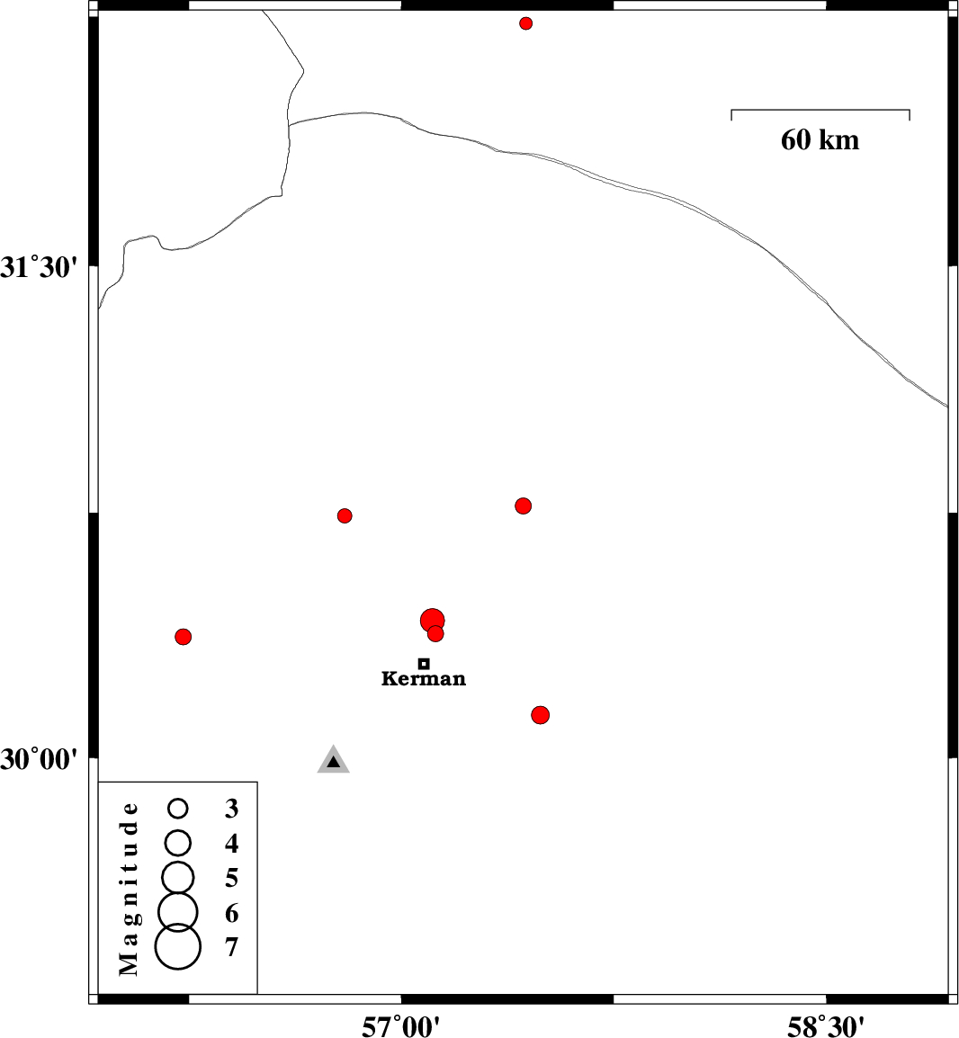
| 2013/11/17 | 18:47:46.0 | 22:17:46.0 | 30.77 | 57.43 | 14 | ML:2.6 | Kerman Province, 63 km North-East of Kerman | ||
| 2013/11/12 | 02:31:22.2 | 06:01:22.2 | 30.38 | 57.12 | 17 | ML:2.6 | Kerman Province, 11 km Kerman | ||
| 2013/11/12 | 02:27:23.4 | 05:57:23.4 | 30.42 | 57.11 | 14 | ML:3.8 | Kerman Province, 15 km North of Kerman | ||
| 2013/10/28 | 23:00:58.3 | 02:30:58.3 | 30.13 | 57.49 | 14 | ML:2.8 | Kerman Province, 43 km South-East of Kerman | ||
| 2013/10/25 | 23:01:22.5 | 02:31:22.5 | 30.74 | 56.8 | 14 | ML:2.3 | Kerman Province, 23 km East of Zarand | ||
| 2013/10/21 | 13:46:06.9 | 17:16:06.9 | 30.37 | 56.23 | 14 | ML:2.5 | Kerman Province, 22 km East of Rafsanjan | ||
| 2013/10/19 | 19:37:46.8 | 23:07:46.8 | 32.23 | 57.44 | 15 | ML:2 | Yazd Province, 123 km North-East of Ravar |