Home / Recent Earthquakes

| Prel. Rep. | Date | Time(UTC) | Time(Local) | Lat. | Lon. | Depth | Mag. | Region | Waveform |
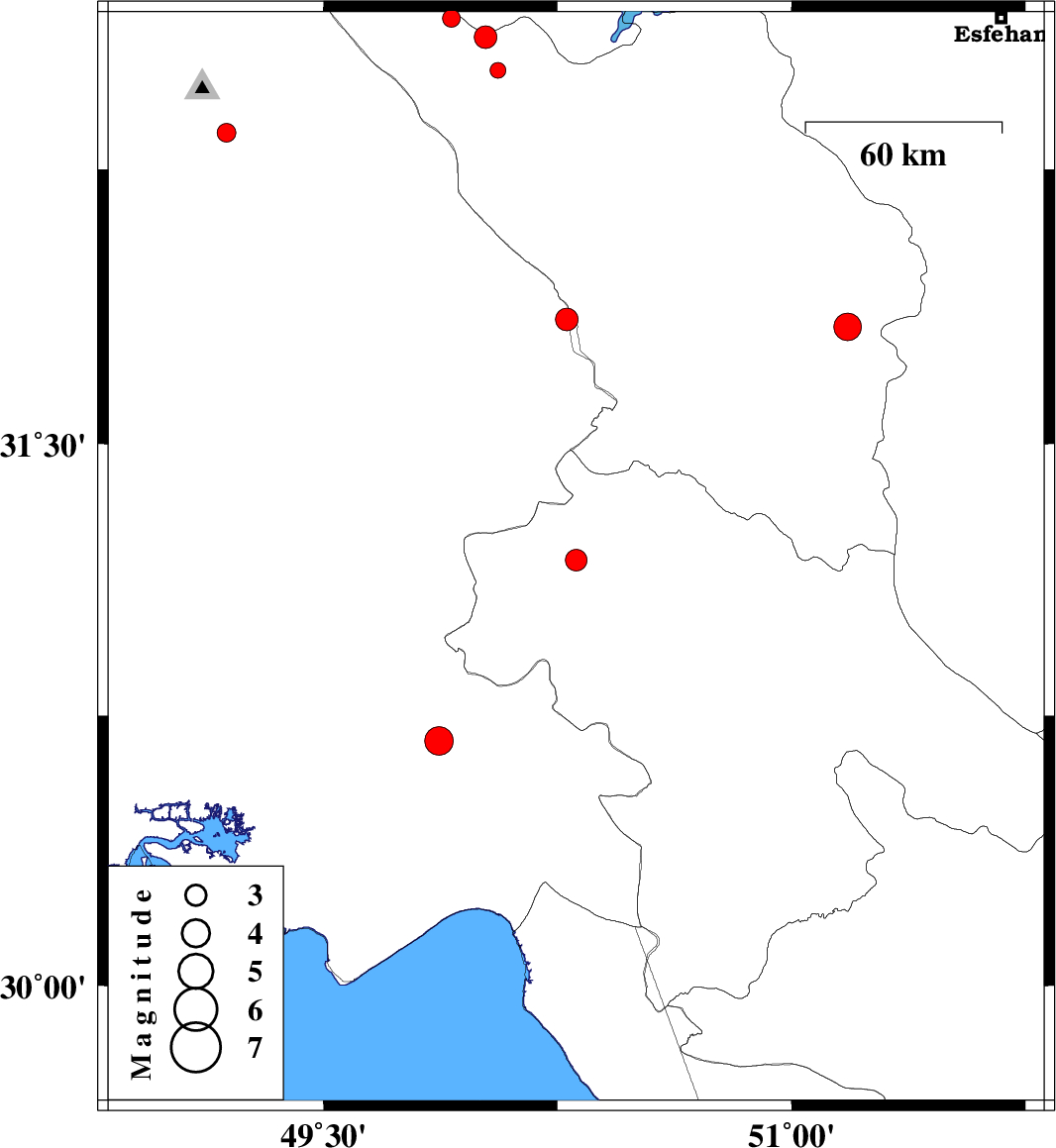
| 2014/03/13 | 10:40:28.9 | 14:10:28.9 | 31.18 | 50.31 | 14 | ML:3.1 | Kohkiluieh va boyerahmad Province, 66 km North of Behbahan | ||
| 2014/03/05 | 17:44:23.8 | 21:14:23.8 | 32.35 | 49.19 | 15 | ML:2.7 | Khoozestan Province, 9 km Lali | ||
| 2014/02/27 | 13:57:25.3 | 17:27:25.3 | 30.68 | 49.87 | 44 | ML:4.1 | Khoozestan Province, 18 km East of Omidiyeh | ||
| 2014/02/22 | 15:25:00.9 | 18:55:00.9 | 32.66 | 49.91 | 14 | ML:2.5 | Chaharmahal Bakhtiari Province, 29 km North-West of Chelgard | ||
| 2014/02/21 | 13:40:08.3 | 17:10:08.3 | 32.52 | 50.06 | 14 | ML:2.3 | Chaharmahal Bakhtiari Province, 9 km Chelgard | ||
| 2014/02/20 | 09:41:14.5 | 13:11:14.5 | 31.84 | 50.28 | 14 | ML:3.2 | Khoozestan Province, 39 km East of Izeh | ||
| 2014/02/17 | 13:34:01.5 | 17:04:01.5 | 32.61 | 50.02 | 14 | ML:3.3 | Chaharmahal Bakhtiari Province, 18 km North-West of Chelgard | ||
| 2014/02/13 | 11:47:36.5 | 15:17:36.5 | 31.82 | 51.18 | 14 | ML:4 | Chaharmahal Bakhtiari Province, 19 km South-West of Borujen |