Home / Recent Earthquakes

| Prel. Rep. | Date | Time(UTC) | Time(Local) | Lat. | Lon. | Depth | Mag. | Region | Waveform |
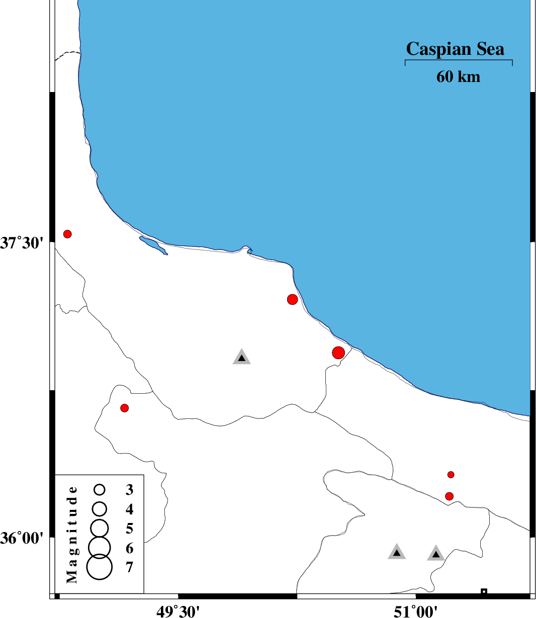
| 2014/04/04 | 18:10:00.7 | 22:40:00.7 | 37.21 | 50.22 | 17 | ML:3 | Gilan Province, 6 km Langarud | ||
| 2014/03/26 | 18:01:52.6 | 22:31:52.6 | 35.82 | 49.16 | 14 | ML:2 | Ghazvin Province, 37 km South of Abhar | ||
| 2014/03/22 | 23:37:23.5 | 04:07:23.5 | 36.32 | 51.22 | 14 | ML:1.8 | Mazandaran Province, 42 km South-West of Chalus | ||
| 2014/03/20 | 11:13:22.5 | 14:43:22.5 | 36.94 | 50.51 | 31 | ML:3.5 | Gilan Province, 13 km West of Ramsar | ||
| 2014/03/17 | 15:43:37.2 | 19:13:37.2 | 36.21 | 51.21 | 18 | ML:2.2 | Mazandaran Province, 50 km North-West of Tajrish | ||
| 2014/03/15 | 05:06:23.2 | 08:36:23.2 | 37.54 | 48.8 | 14 | ML:2.3 | Gilan Province, 26 km East of Khalkhal | ||
| 2014/03/10 | 16:10:09.4 | 19:40:09.4 | 36.66 | 49.16 | 28 | ML:2.3 | Ghazvin Province, 30 km South-West of Rudbar |