
| Prel. Rep. | Date | Time(UTC) | Time(Local) | Lat. | Lon. | Depth | Mag. | Region | Waveform |
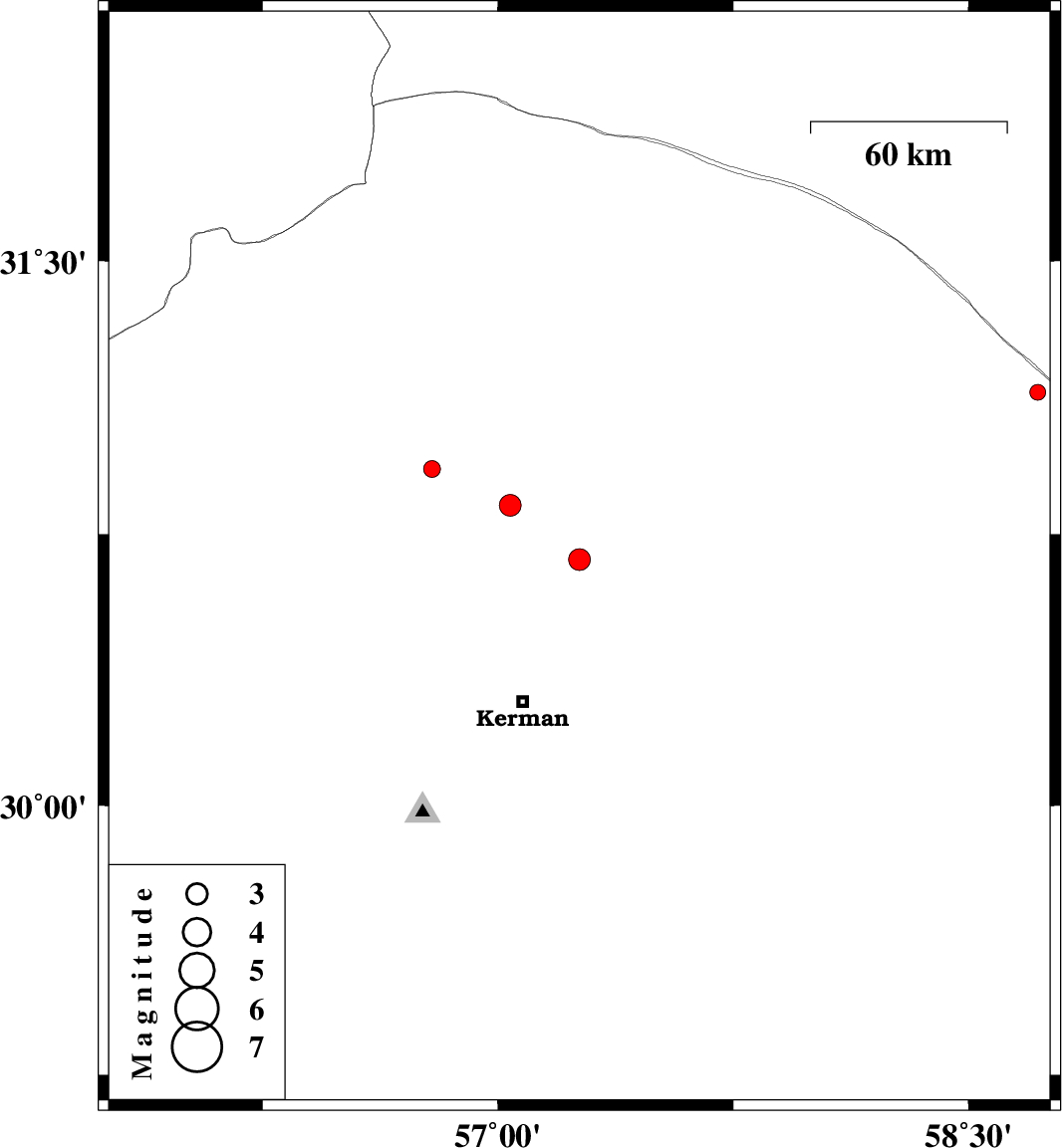
| 2014/07/28 | 13:02:15.4 | 17:32:15.4 | 30.68 | 57.26 | 14 | ML:3.1 | Kerman Province, 47 km North-East of Kerman | ||
| 2014/07/28 | 11:36:42.1 | 16:06:42.1 | 30.93 | 56.79 | 18 | ML:2.4 | Kerman Province, 25 km North-East of Zarand | ||
| 2014/07/27 | 00:04:14.9 | 04:34:14.9 | 30.83 | 57.04 | 14 | ML:3.1 | Kerman Province, 45 km East of Zarand | ||
| 2014/07/26 | 21:34:16.3 | 02:04:16.3 | 31.14 | 58.72 | 15 | ML:2.2 | Kerman Province, 133 km South-West of Nehbandan |

 IIEES All Rights Reserved