Home / Recent Earthquakes

| Prel. Rep. | Date | Time(UTC) | Time(Local) | Lat. | Lon. | Depth | Mag. | Region | Waveform |
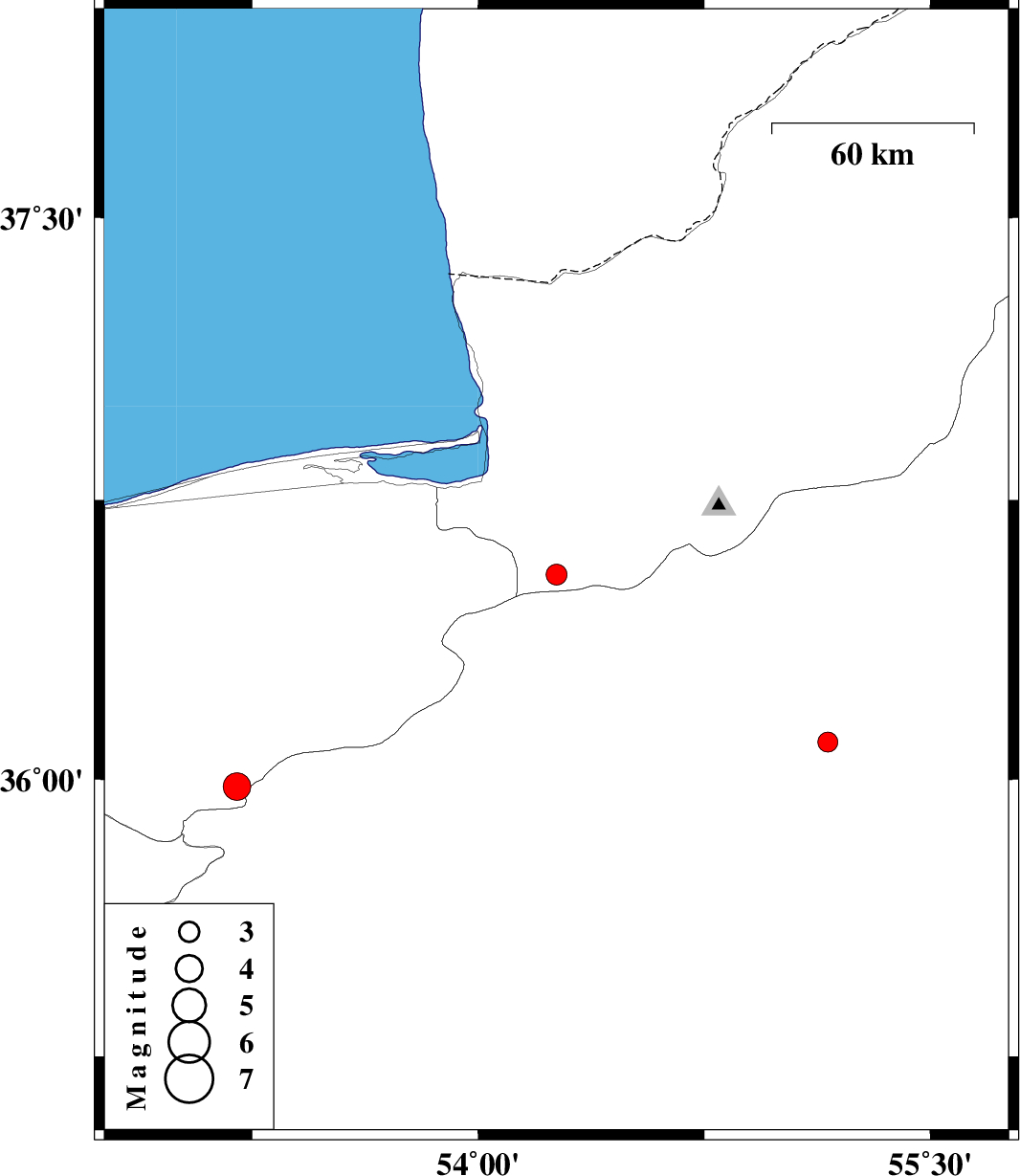
| 2014/09/17 | 12:32:18.4 | 17:02:18.4 | 36.55 | 54.26 | 14 | ML:3.1 | Golestan Province, 30 km South-East of Kordkuy | ||
| 2014/09/16 | 02:54:48.2 | 07:24:48.2 | 36.1 | 55.16 | 14 | ML:3 | Semnan Province, 39 km South-East of Shahrud | ||
| 2014/09/16 | 00:39:43.7 | 05:09:43.7 | 35.98 | 53.2 | 6 | ML:4.1 | Mazandaran Province, 20 km South-East of Pol-E-Sefid |