Home / Recent Earthquakes

| Prel. Rep. | Date | Time(UTC) | Time(Local) | Lat. | Lon. | Depth | Mag. | Region | Waveform |
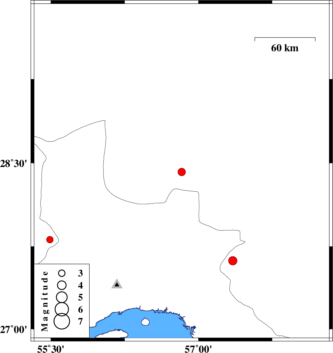
| 2015/03/15 | 09:26:57.7 | 12:56:57.7 | 28.42 | 56.83 | 15 | ML:3.5 | Kerman Province, 93 km South-East of Baft | ||
| 2015/03/13 | 06:00:36.6 | 09:30:36.6 | 27.62 | 57.35 | 14 | ML:4 | Kerman Province, 24 km North-East of Dehbarez | ||
| 2015/03/10 | 18:20:33.8 | 21:50:33.8 | 27.81 | 55.49 | 14 | ML:3.1 | Fars Province, 69 km South-West of Hajiabad |