Home / Recent Earthquakes

| Prel. Rep. | Date | Time(UTC) | Time(Local) | Lat. | Lon. | Depth | Mag. | Region | Waveform |
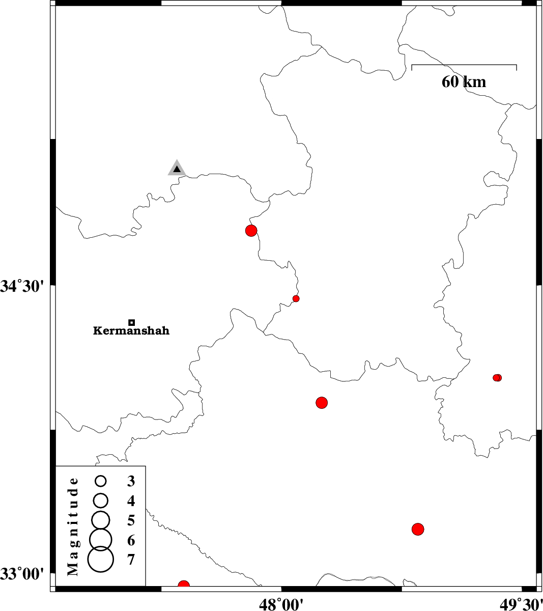
| 2015/04/05 | 15:32:36.2 | 20:02:36.2 | 34.43 | 48.09 | 14 | ML:1.8 | Kermanshah Province, 15 km East of Kangavar | ||
| 2015/04/05 | 01:21:40.9 | 05:51:40.9 | 32.93 | 47.39 | 14 | ML:3.3 | Ilam Province, 7 km Abdanan | ||
| 2015/04/04 | 23:36:29.6 | 04:06:29.6 | 33.89 | 48.25 | 14 | ML:3.3 | Lorestan Province, 5 km Aleshtar | ||
| 2015/03/30 | 01:04:28.0 | 05:34:28.0 | 33.23 | 48.85 | 14 | ML:3.4 | Lorestan Province, 34 km South-West of Dorud | ||
| 2015/03/21 | 04:35:58.7 | 08:05:58.7 | 34.78 | 47.81 | 14 | ML:3.3 | Kermanshah Province, 20 km East of Sonqor | ||
| 2015/03/16 | 13:22:40.1 | 16:52:40.1 | 34.02 | 49.34 | 36 | ML:1.8 | Markazi Province, 12 km Shazand | ||
| 2015/03/16 | 12:48:58.6 | 16:18:58.6 | 34.02 | 49.35 | 30 | ML:2 | Markazi Province, 12 km Shazand |