Home / Recent Earthquakes

| Prel. Rep. | Date | Time(UTC) | Time(Local) | Lat. | Lon. | Depth | Mag. | Region | Waveform |
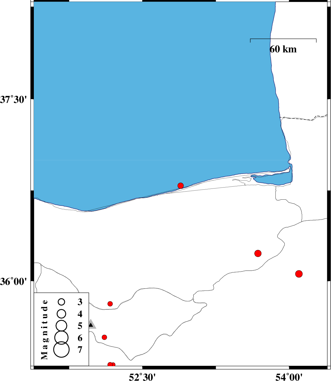
| 2015/04/17 | 23:21:36.9 | 03:51:36.9 | 36.79 | 52.89 | 14 | ML:2.7 | Caspian Sea, 17 km North of Joybar | ||
| 2015/04/10 | 00:10:30.2 | 04:40:30.2 | 35.5 | 51.85 | 14 | ML:2.4 | Tehran Province, 16 km East of Pakdasht | ||
| 2015/04/09 | 06:07:50.2 | 10:37:50.2 | 35.81 | 52.17 | 14 | ML:2.3 | Mazandaran Province, 14 km Damavand | ||
| 2015/04/08 | 02:11:34.4 | 06:41:34.4 | 36.23 | 53.68 | 14 | ML:3.1 | Mazandaran Province, 53 km South-East of Behshahr | ||
| 2015/04/06 | 05:18:13.0 | 09:48:13.0 | 36.06 | 54.1 | 14 | ML:3.2 | Semnan Province, 26 km South-West of Damghan | ||
| 2015/04/01 | 03:18:50.3 | 07:48:50.3 | 35.3 | 52.17 | 14 | ML:2.3 | Semnan Province, 18 km West of Garmsar | ||
| 2015/03/18 | 21:15:36.5 | 00:45:36.5 | 35.3 | 52.2 | 14 | ML:2 | Semnan Province, 15 km West of Garmsar | ||
| 2015/03/18 | 09:16:40.2 | 12:46:40.2 | 35.62 | 51.57 | 14 | ML:1.5 | Tehran Province, 12 km East of Rey | ||
| 2015/03/18 | 01:18:04.3 | 04:48:04.3 | 35.53 | 52.11 | 17 | ML:2.2 | Tehran Province, 21 km South of Damavand |