
Magnitude |
3.4 |
| Date & Time (UTC) | 2015-10-11 19:11:30.6 |
| Date & Time (Local) | 1394/7/19 22:41:30.6 |
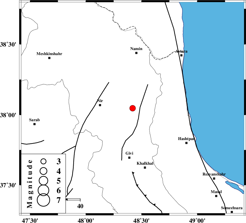
| Location | Lat:38.047 Lon: 48.42 |
| Region | Ardebil Province, 26 km -East of Nir |
Nearest Cities |
|
| 1 km of Budalalu, Ardebil Province | |
| 4 km of Mehmandust, Ardebil Province | |
| 14 km West of Hir, Ardebil Province | |
| 17 km North East of Kuraeim, Ardebil Province | |
| 25 km South East of Ardabil, Ardebil Province | |
| Depth | 14 km |
| Agency | |
Faults within 150 km: |
|
| SANGAVAR_F (Length: 61 km) , Distance to epicenter: 6 km | |
| BOZQUSH (Length: 70 km) , Distance to epicenter: 28 km | |
| TALESH_F (Length: 258 km) , Distance to epicenter: 47 km | |
| Number of Phases | 6 |
| RMS | 0.3 |
| Number of Stations | 4 |
| Error in Latitude | >3.3 km |
| Error in Longitude | 5.5 km |
| Error in Depth | 7.3 km |
Download waveform in seisan format
to download seisan software Click here
to access information about IIEES stations Click here
Amplitude | ||||||||
| UID | Agency | Station | Component | Amplitude | Period | Arrival Time | Proccessing Time | Signal Clip |
| 101664 | IIEES | ZNJK | E | 833.3 | 0.31 | 2015-10-11 19:12:17 | 2015-10-12 05:18:00 | n |
| 101665 | IIEES | ZNJK | N | 474.2 | 0.25 | 2015-10-11 19:12:18 | 2015-10-12 05:18:00 | n |
Phase | ||||||||||||
| Agency | Station | Component | Phase Type | Phase Quality | First Motion | Observed Arrival Time | Time Residual | Loc. Flag | Input Weight | Distance | Azimuth | |
| IIEES | GRMI | Z | Pg | E | 2015-10-11 19:11:46 | -0.35 | y | 96.3 | 332 | |||
| IIEES | GRMI | N | Sg | E | 2015-10-11 19:11:59 | 0.06 | y | 96.3 | 332 | |||
| IIEES | ZNJK | Z | Pg | E | 2015-10-11 19:11:56 | -0.29 | y | 155 | 171 | |||
| IIEES | CHTH | Z | Pn | E | 2015-10-11 19:12:21 | 0.44 | y | 338 | 134 | |||
| IIEES | MAKU | Z | Pn | E | 2015-10-11 19:12:22 | 0 | y | 356 | 295 | |||
| IIEES | MAKU | N | Sg | E | 2015-10-11 19:13:10 | 0.22 | y | 356 | 295 | |||