
Magnitude |
2.5 |
| Date & Time (UTC) | 2017-01-27 20:42:36.6 |
| Date & Time (Local) | 1395/11/9 00:12:36.6 |
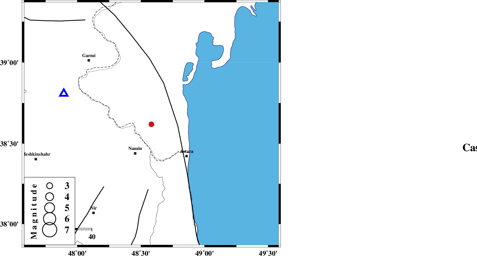
| Location | Lat:38.619 Lon: 48.582 |
| Region | Azerbaijan, 23 km North-East of Namin |
Nearest Cities |
|
| 17 km North East of Anbaran, Ardebil Province | |
| 21 km North East of Lurun, Ardebil Province | |
| 22 km North East of Khaneh zeinian, Ardebil Province | |
| 23 km North East of Namin, Ardebil Province | |
| 27 km North of Kiladeh, Gilan Province | |
| Depth | 18 km |
| Agency | |
Faults within 150 km: |
|
| TALESH_F (Length: 258 km) , Distance to epicenter: 18 km | |
| SANGAVAR_F (Length: 61 km) , Distance to epicenter: 45 km | |
| BOZQUSH (Length: 70 km) , Distance to epicenter: 54 km | |
| Number of Phases | 6 |
| RMS | 0.1 |
| Number of Stations | 4 |
| Error in Latitude | >4.6 km |
| Error in Longitude | 9.2 km |
| Error in Depth | 5.2 km |
Download waveform in seisan format
to download seisan software Click here
to access information about IIEES stations Click here
Amplitude | ||||||||
| UID | Agency | Station | Component | Amplitude | Period | Arrival Time | Proccessing Time | Signal Clip |
| 112639 | IIEES | GRMI | N | 352.8 | 0.21 | 2017-01-27 20:42:57 | 2017-01-28 06:35:00 | n |
| 112640 | IIEES | GRMI | E | 309.6 | 0.21 | 2017-01-27 20:42:57 | 2017-01-28 06:35:00 | n |
| 112641 | IIEES | MAKU | N | 8.9 | 0.49 | 2017-01-27 20:44:19 | 2017-01-28 06:35:00 | n |
Phase | ||||||||||||
| Agency | Station | Component | Phase Type | Phase Quality | First Motion | Observed Arrival Time | Time Residual | Loc. Flag | Input Weight | Distance | Azimuth | |
| IIEES | GRMI | Z | Pg | E | 2017-01-27 20:42:48 | 0.13 | y | 63.5 | 290 | |||
| IIEES | GRMI | N | Sg | E | 2017-01-27 20:42:56 | 0.02 | y | 63.5 | 290 | |||
| IIEES | ZNJK | Z | Pn | E | 2017-01-27 20:43:11 | 0.15 | y | 216 | 178 | |||
| IIEES | ZNJK | N | Sg | E | 2017-01-27 20:43:38 | 0.02 | y | 216 | 178 | |||
| IIEES | MAKU | Z | Pn | E | 2017-01-27 20:43:27 | -0.19 | y | 348 | 285 | |||
| IIEES | SNGE | Z | Pn | E | 2017-01-27 20:43:34 | -0.2 | y | 406 | 196 | |||