
Magnitude |
3 |
| Date & Time (UTC) | 2011-02-24 06:16:51.2 |
| Date & Time (Local) | 1389/12/5 09:46:51.2 |
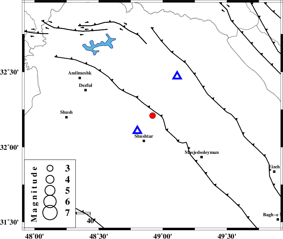
| Location | Lat:32.21 Lon: 48.92 |
| Region | Khoozestan Province, 19 km North of Shushtar |
Nearest Cities |
|
| 7 km North of Samaleh, Khoozestan Province | |
| 11 km East of Gatvand, Khoozestan Province | |
| 16 km North West of Haft shahidan, Khoozestan Province | |
| 20 km North of Shushtar, Khoozestan Province | |
| 20 km West of Jaefarabad, Khoozestan Province | |
| Depth | 26 km |
| Agency | |
Faults within 150 km: |
|
| DEZFUL_EMBAYMENT (Length: 228 km) , Distance to epicenter: 5 km | |
| MFF2 (Length: 205 km) , Distance to epicenter: 43 km | |
| BALARUD_F_Z2 (Length: 58 km) , Distance to epicenter: 53 km | |
| Number of Phases | 4 |
| RMS | 0 |
| Number of Stations | 4 |
| Error in Latitude | >7 km |
| Error in Longitude | 6.3 km |
| Error in Depth | 4.7 km |
Download waveform in seisan format
to download seisan software Click here
to access information about IIEES stations Click here
Amplitude | ||||||||
| UID | Agency | Station | Component | Amplitude | Period | Arrival Time | Proccessing Time | Signal Clip |
| 78091 | IIEES | SHGR | E | 4009.7 | 0.17 | 2011-02-24 06:17:02 | 2011-02-24 06:40:00 | n |
| 78092 | IIEES | SHGR | N | 6839.9 | 0.5 | 2011-02-24 06:17:02 | 2011-02-24 06:40:00 | n |
| 78093 | IIEES | KHMZ | N | 93.5 | 0.92 | 2011-02-24 06:17:49 | 2011-02-24 06:40:00 | n |
| 78094 | IIEES | ASAO | N | 37.2 | 1.17 | 2011-02-24 06:18:13 | 2011-02-24 06:40:00 | n |
Phase | ||||||||||||
| Agency | Station | Component | Phase Type | Phase Quality | First Motion | Observed Arrival Time | Time Residual | Loc. Flag | Input Weight | Distance | Azimuth | |
| IIEES | SHGR | Z | Pg | E | 2011-02-24 06:16:56 | 0 | y | 15.2 | 225 | |||
| IIEES | KHMZ | Z | Pg | E | 2011-02-24 06:17:23 | 0 | y | 196 | 30 | |||
| IIEES | ASAO | Z | Pn | E | 2011-02-24 06:17:32 | 0 | y | 280 | 21 | |||
| IIEES | SNGE | Z | Pn | E | 2011-02-24 06:17:41 | 0 | y | 352 | 336 | |||