
Magnitude |
1.9 |
| Date & Time (UTC) | 2012-09-11 09:00:54.8 |
| Date & Time (Local) | 1391/6/21 13:30:54.8 |
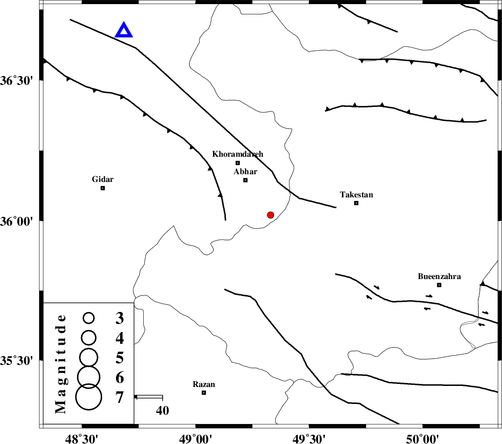
| Location | Lat:36.02 Lon: 49.33 |
| Region | Zanjan Province, 17 km South-East of Abhar |
Nearest Cities |
|
| 8 km of Darsajin, Zanjan Province | |
| 10 km West of Farsejin, Ghazvin Province | |
| 11 km North West of Ziaabad, Ghazvin Province | |
| 12 km East of Khalifeh hesar, Zanjan Province | |
| 14 km South of Sharifabad, Zanjan Province | |
| Depth | 14 km |
| Agency | |
Faults within 150 km: |
|
| ZANJAN_F (Length: 137 km) , Distance to epicenter: 12 km | |
| SOLTANIYEH_F (Length: 119 km) , Distance to epicenter: 18 km | |
| KUSHK_E_NOSRAT_F (Length: 230 km) , Distance to epicenter: 33 km | |
| Number of Phases | 5 |
| RMS | 0.2 |
| Number of Stations | 4 |
| Error in Latitude | >2.7 km |
| Error in Longitude | 2 km |
| Error in Depth | 5 km |
Download waveform in seisan format
to download seisan software Click here
to access information about IIEES stations Click here
Amplitude | ||||||||
| UID | Agency | Station | Component | Amplitude | Period | Arrival Time | Proccessing Time | Signal Clip |
| 86083 | IIEES | CHTH | E | 16.8 | 0.4 | 2012-09-11 09:01:47 | 2012-09-11 09:56:00 | n |
| 86084 | IIEES | GHVR | N | 6 | 0.5 | 2012-09-11 09:02:06 | 2012-09-11 09:56:00 | n |
| 86085 | IIEES | GHVR | E | 7.9 | 0.37 | 2012-09-11 09:02:15 | 2012-09-11 09:56:00 | n |
Phase | ||||||||||||
| Agency | Station | Component | Phase Type | Phase Quality | First Motion | Observed Arrival Time | Time Residual | Loc. Flag | Input Weight | Distance | Azimuth | |
| IIEES | ZNJK | Z | Pg | E | 2012-09-11 09:01:10 | 0.1 | y | 92.1 | 322 | |||
| IIEES | CHTH | Z | Pg | E | 2012-09-11 09:01:21 | -0.2 | y | 163 | 94 | |||
| IIEES | SNGE | Z | Pn | E | 2012-09-11 09:01:28 | -0.11 | y | 207 | 241 | |||
| IIEES | SNGE | E | Sg | E | 2012-09-11 09:01:53 | -0.02 | y | 207 | 241 | |||
| IIEES | GHVR | Z | Pn | E | 2012-09-11 09:01:33 | 0.24 | y | 244 | 134 | |||