
Magnitude |
3.5 |
| Date & Time (UTC) | 2013-12-16 08:52:07.9 |
| Date & Time (Local) | 1392/9/25 12:22:07.9 |
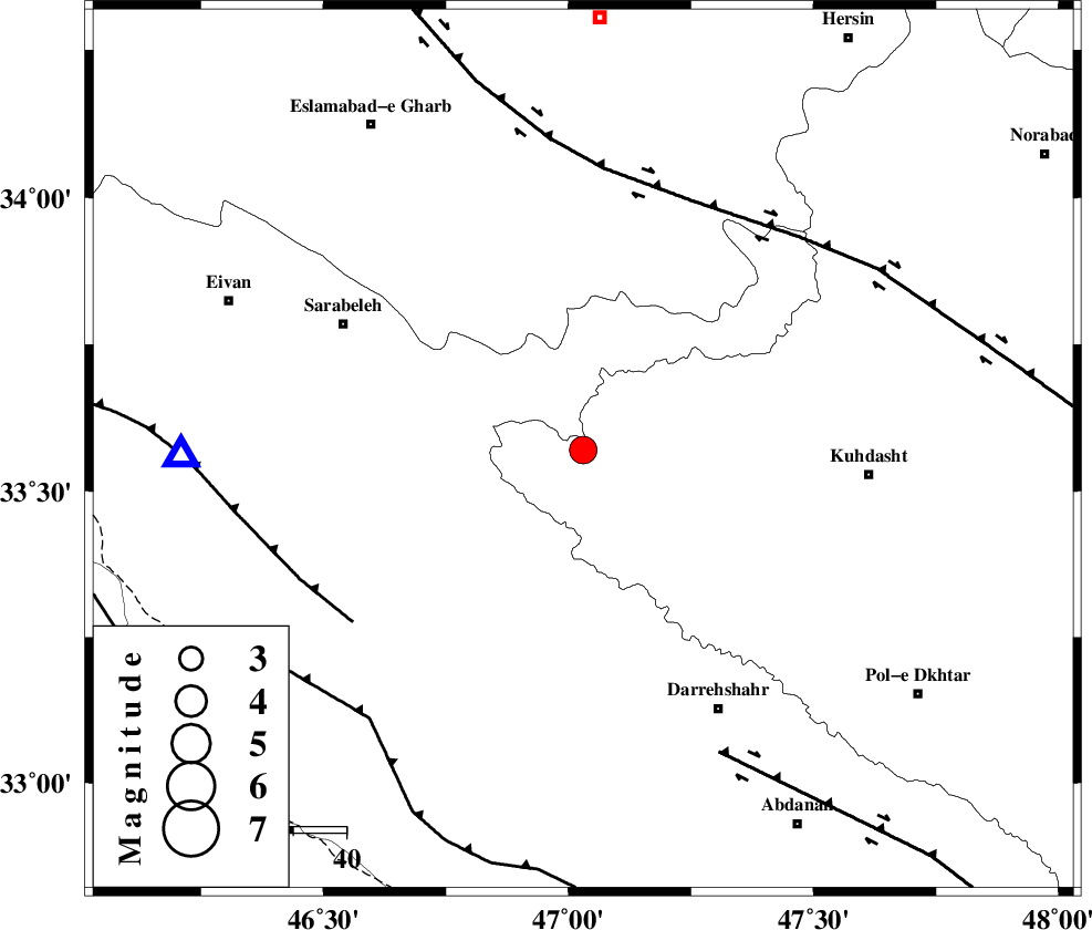
| Location | Lat:33.57 Lon: 47.03 |
| Region | Lorestan Province, 55 km West of Kuhdasht |
Nearest Cities |
|
| 23 km East of Belaveh tare-e sofla, Ilam Province | |
| 23 km North West of Garab, Lorestan Province | |
| 32 km East of Sartang-e malehmaran, Ilam Province | |
| 34 km North of Badreh, Ilam Province | |
| 34 km North West of Kunani, Lorestan Province | |
| Depth | 15 km |
| Agency | |
Faults within 150 km: |
|
| HZF4 (Length: 492 km) , Distance to epicenter: 51 km | |
| MFF7 (Length: 99 km) , Distance to epicenter: 55 km | |
| BALARUD_F_Z1 (Length: 87 km) , Distance to epicenter: 63 km | |
| Number of Phases | 6 |
| RMS | 0.3 |
| Number of Stations | 6 |
| Error in Latitude | >4.8 km |
| Error in Longitude | 9.1 km |
| Error in Depth | 0 km |
Download waveform in seisan format
to download seisan software Click here
to access information about IIEES stations Click here
Amplitude | ||||||||
| UID | Agency | Station | Component | Amplitude | Period | Arrival Time | Proccessing Time | Signal Clip |
| 91218 | IIEES | SHGR | E | 311.9 | 0.34 | 2013-12-16 08:53:22 | 2013-12-16 09:45:00 | n |
| 91219 | IIEES | SHGR | N | 332.9 | 0.57 | 2013-12-16 08:53:34 | 2013-12-16 09:45:00 | n |
Phase | ||||||||||||
| Agency | Station | Component | Phase Type | Phase Quality | First Motion | Observed Arrival Time | Time Residual | Loc. Flag | Input Weight | Distance | Azimuth | |
| IIEES | SHGR | Z | Pn | E | 2013-12-16 08:52:44 | 0.03 | y | 232 | 134 | |||
| IIEES | KHMZ | Z | Pn | E | 2013-12-16 08:52:49 | -0.28 | y | 273 | 85 | |||
| IIEES | ASAO | Z | Pn | E | 2013-12-16 08:52:53 | 0.62 | y | 297 | 68 | |||
| IIEES | ZNJK | Z | Pn | E | 2013-12-16 08:53:02 | 0.02 | y | 376 | 23 | |||
| IIEES | CHTH | Z | Pn | E | 2013-12-16 08:53:12 | -0.35 | y | 456 | 54 | |||
| IIEES | DAMV | Z | Pn | E | 2013-12-16 08:53:18 | -0.15 | y | 508 | 62 | |||