Home / Recent Earthquakes

| Prel. Rep. | Date | Time(UTC) | Time(Local) | Lat. | Lon. | Depth | Mag. | Region | Waveform |
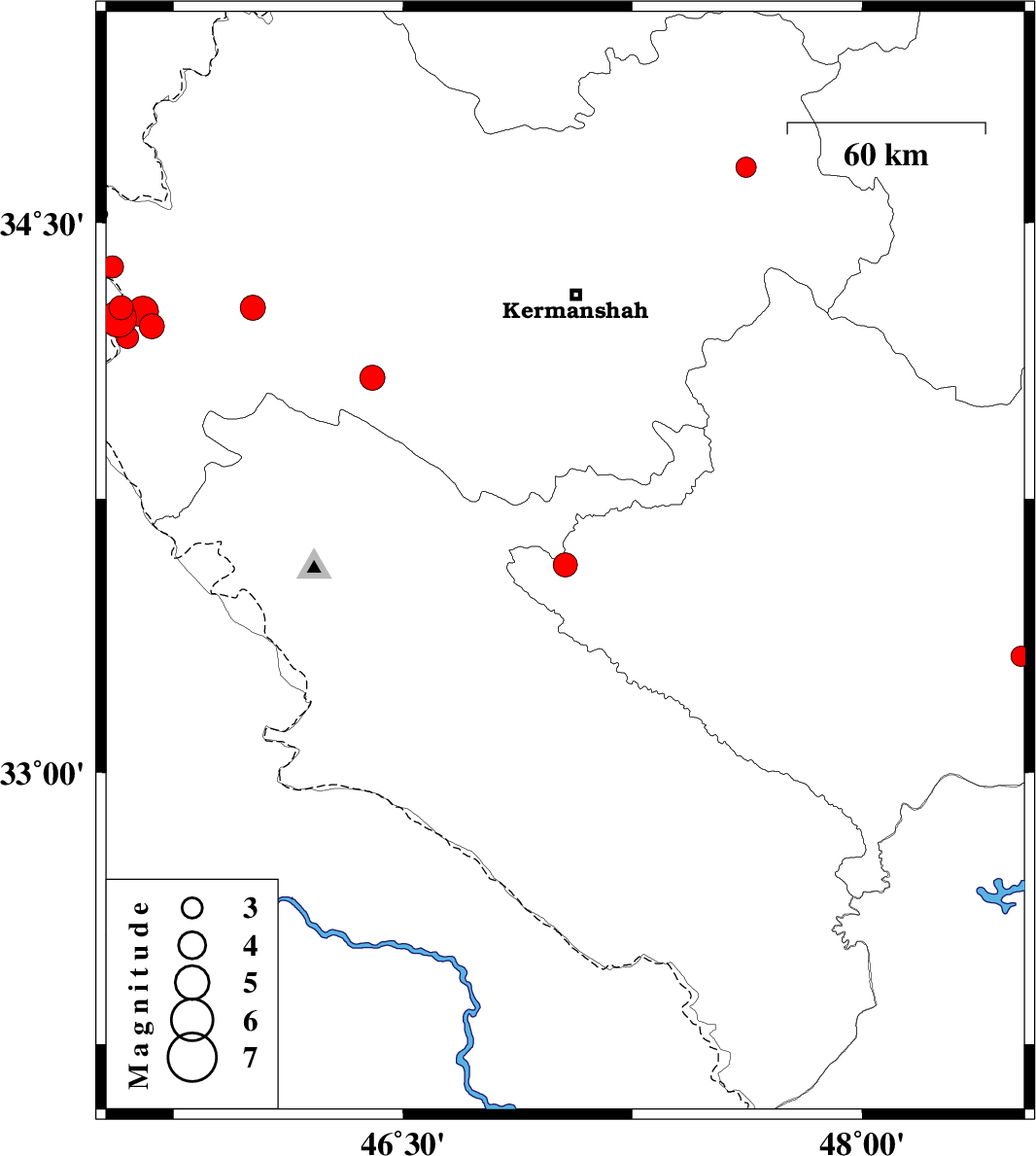
| 2013/12/16 | 08:52:07.9 | 12:22:07.9 | 33.57 | 47.03 | 15 | ML:3.5 | Lorestan Province, 55 km West of Kuhdasht | ||
| 2013/12/10 | 16:33:09.2 | 20:03:09.2 | 34.27 | 46.01 | 14 | ML:3.6 | Kermanshah Province, 16 km North of Gilan-E-Gharb | ||
| 2013/12/01 | 18:45:55.2 | 22:15:55.2 | 34.08 | 46.4 | 18 | ML:3.6 | Kermanshah Province, 19 km West of Eslam Abad-E-Gharb | ||
| 2013/11/27 | 19:33:47.8 | 23:03:47.8 | 33.32 | 48.52 | 14 | ML:2.9 | Lorestan Province, 23 km South-East of Khorramabad | ||
| 2013/11/25 | 03:23:07.9 | 06:53:07.9 | 34.22 | 45.68 | 18 | ML:3.7 | Kermanshah Province, 23 km West of Gilan-E-Gharb | ||
| 2013/11/25 | 00:52:51.1 | 04:22:51.1 | 34.27 | 45.58 | 14 | ML:3.5 | Iraq, 28 km South of Qasr-E-Shirin | ||
| 2013/11/24 | 18:05:43.1 | 21:35:43.1 | 34.24 | 45.57 | 17 | ML:5.3 | Iraq, 30 km South of Qasr-E-Shirin | ||
| 2013/11/24 | 18:03:15.0 | 21:33:15.0 | 34.26 | 45.65 | 14 | ML:4.5 | Kermanshah Province, 29 km South of Qasr-E-Shirin | ||
| 2013/11/23 | 06:52:02.4 | 10:22:02.4 | 34.26 | 45.58 | 15 | ML:3.8 | Iraq, 28 km South of Qasr-E-Shirin | ||
| 2013/11/22 | 23:43:45.7 | 03:13:45.7 | 34.19 | 45.6 | 15 | ML:3.2 | Kermanshah Province, 36 km South of Qasr-E-Shirin | ||
| 2013/11/22 | 21:08:02.8 | 00:38:02.8 | 34.38 | 45.55 | 15 | ML:3.3 | Kermanshah Province, 15 km South of Qasr-E-Shirin | ||
| 2013/11/17 | 14:42:51.5 | 18:12:51.5 | 34.65 | 47.62 | 18 | ML:2.9 | Kermanshah Province, 16 km South of Sonqor |