
Magnitude |
2.9 |
| Date & Time (UTC) | 2013-11-27 19:33:47.8 |
| Date & Time (Local) | 1392/9/6 23:03:47.8 |
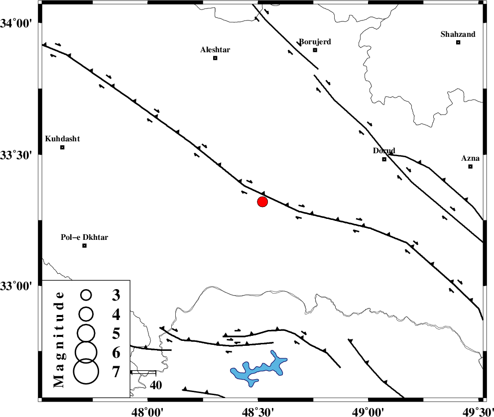
| Location | Lat:33.32 Lon: 48.52 |
| Region | Lorestan Province, 23 km South-East of Khorramabad |
Nearest Cities |
|
| 12 km West of Emanabad, Lorestan Province | |
| 16 km South of Kamalvand-e gholamali, Lorestan Province | |
| 17 km East of Daraei, Lorestan Province | |
| 21 km South East of Badrabad-e sofla, Lorestan Province | |
| 23 km South East of Khorramabad, Lorestan Province | |
| Depth | 14 km |
| Agency | |
Faults within 150 km: |
|
| HZF4 (Length: 492 km) , Distance to epicenter: 10 km | |
| DORUD (Length: 100 km) , Distance to epicenter: 52 km | |
| BALARUD_F_Z2 (Length: 58 km) , Distance to epicenter: 55 km | |
| Number of Phases | 7 |
| RMS | 0 |
| Number of Stations | 5 |
| Error in Latitude | >1.5 km |
| Error in Longitude | 5.3 km |
| Error in Depth | 2.9 km |
Download waveform in seisan format
to download seisan software Click here
to access information about IIEES stations Click here
Amplitude | ||||||||
| UID | Agency | Station | Component | Amplitude | Period | Arrival Time | Proccessing Time | Signal Clip |
| 91088 | IIEES | SHGR | E | 218.6 | 0.64 | 2013-11-27 19:34:31 | 2013-11-27 08:00:00 | n |
| 91089 | IIEES | GHVR | E | 49.4 | 0.48 | 2013-11-27 19:35:15 | 2013-11-27 08:00:00 | n |
Phase | ||||||||||||
| Agency | Station | Component | Phase Type | Phase Quality | First Motion | Observed Arrival Time | Time Residual | Loc. Flag | Input Weight | Distance | Azimuth | |
| IIEES | SHGR | Z | Pg | E | 2013-11-27 19:34:10 | -0.02 | y | 137 | 169 | |||
| IIEES | SHGR | E | Sg | E | 2013-11-27 19:34:27 | 0.01 | y | 137 | 169 | |||
| IIEES | ASAO | Z | Pg | E | 2013-11-27 19:34:19 | -0.07 | y | 195 | 45 | |||
| IIEES | ASAO | E | Sg | E | 2013-11-27 19:34:43 | 0 | y | 195 | 45 | |||
| IIEES | GHVR | Z | Pn | E | 2013-11-27 19:34:30 | 0.03 | y | 283 | 62 | |||
| IIEES | CHTH | Z | Pn | E | 2013-11-27 19:34:42 | 0.05 | y | 373 | 39 | |||
| IIEES | DAMV | Z | Pn | E | 2013-11-27 19:34:46 | 0 | y | 408 | 50 | |||