Home / Recent Earthquakes

| Prel. Rep. | Date | Time(UTC) | Time(Local) | Lat. | Lon. | Depth | Mag. | Region | Waveform |
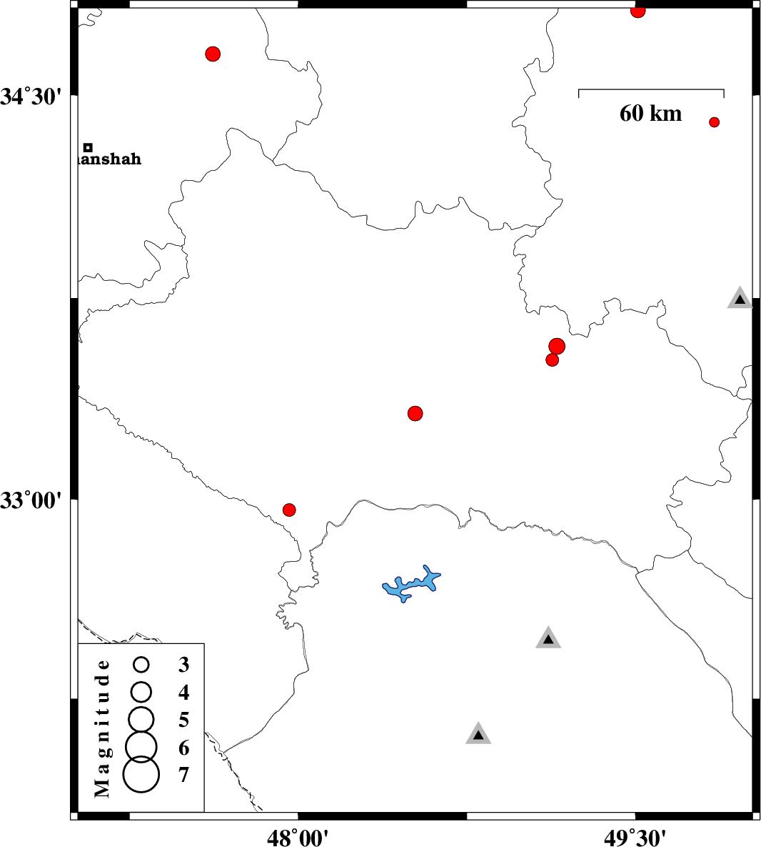
| 2013/11/27 | 19:33:47.8 | 23:03:47.8 | 33.32 | 48.52 | 14 | ML:2.9 | Lorestan Province, 23 km South-East of Khorramabad | ||
| 2013/11/17 | 14:42:51.5 | 18:12:51.5 | 34.65 | 47.62 | 18 | ML:2.9 | Kermanshah Province, 16 km South of Sonqor | ||
| 2013/11/12 | 09:50:14.7 | 13:20:14.7 | 33.52 | 49.13 | 6 | ML:2.5 | Lorestan Province, 6 km Dorud | ||
| 2013/11/12 | 09:09:57.0 | 12:39:57.0 | 33.57 | 49.15 | 6 | ML:3.3 | Lorestan Province, 12 km Dorud | ||
| 2013/11/04 | 18:05:01.0 | 21:35:01.0 | 34.81 | 49.51 | 20 | ML:2.9 | Markazi Province, 49 km North-West of Tafresh | ||
| 2013/11/04 | 00:21:20.8 | 03:51:20.8 | 34.4 | 49.85 | 6 | ML:2 | Markazi Province, 20 km South-West of Ashtiyan | ||
| 2013/11/01 | 01:58:18.1 | 05:28:18.1 | 32.96 | 47.96 | 18 | ML:2.5 | Lorestan Province, 32 km South-East of Pol-e dokhtar |