
Magnitude |
3.9 |
| Date & Time (UTC) | 2015-01-31 18:06:00.2 |
| Date & Time (Local) | 1393/11/11 21:36:00.2 |
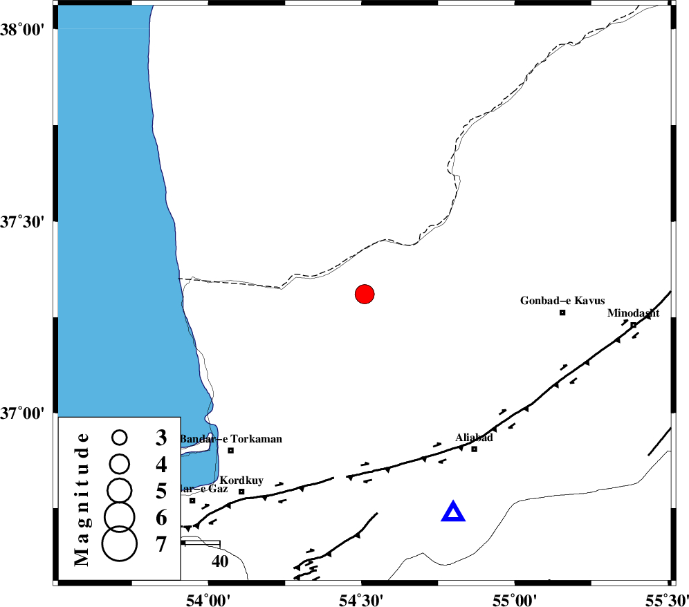
| Location | Lat:37.31 Lon: 54.51 |
| Region | Golestan Province, 33 km North of Aq Qaleh |
Nearest Cities |
|
| 25 km South West of Enchehborun, Golestan Province | |
| 32 km North West of Gariduji, Golestan Province | |
| 33 km North of Qanqarmeh, Golestan Province | |
| 34 km North of Aq Qaleh, Golestan Province | |
| 38 km North of Nodeh malek, Golestan Province | |
| Depth | 18 km |
| Agency | |
Faults within 150 km: |
|
| KHAZAR_F (Length: 523 km) , Distance to epicenter: 51 km | |
| N_ALBORZ_F (Length: 360 km) , Distance to epicenter: 78 km | |
| SHAVAR_F (Length: 87 km) , Distance to epicenter: 83 km | |
| Number of Phases | 7 |
| RMS | 0.1 |
| Number of Stations | 8 |
| Error in Latitude | >8.4 km |
| Error in Longitude | 3.9 km |
| Error in Depth | 9 km |
Download waveform in seisan format
to download seisan software Click here
to access information about IIEES stations Click here
Amplitude | ||||||||
| UID | Agency | Station | Component | Amplitude | Period | Arrival Time | Proccessing Time | Signal Clip |
| 94914 | IIEES | DAMV | E | 439.5 | 0.2 | 2015-01-31 18:07:33 | 2015-01-31 06:50:00 | n |
| 94915 | IIEES | THKV | N | 303 | 0.32 | 2015-01-31 18:07:51 | 2015-01-31 06:50:00 | n |
Phase | ||||||||||||
| Agency | Station | Component | Phase Type | Phase Quality | First Motion | Observed Arrival Time | Time Residual | Loc. Flag | Input Weight | Distance | Azimuth | |
| IIEES | DAMV | E | Sg | E | 2015-01-31 18:07:23 | -0.03 | y | 294 | 231 | |||
| IIEES | CHTH | N | Sg | E | 2015-01-31 18:07:35 | 0.07 | y | 340 | 244 | |||
| IIEES | GHVR | Z | Pn | E | 2015-01-31 18:07:00 | -0.11 | y | 430 | 224 | |||
| IIEES | TABS | Z | Pn | E | 2015-01-31 18:07:06 | 0.14 | y | 470 | 149 | |||
| IIEES | NASN | Z | Pn | E | 2015-01-31 18:07:12 | -0.04 | y | 524 | 198 | |||
| IIEES | YZKH | Z | Pn | E | 2015-01-31 18:07:15 | -0.08 | y | 546 | 179 | |||
| IIEES | BSRN | Z | Pn | E | 2015-01-31 18:07:38 | 0.05 | y | 728 | 143 | |||

 IIEES All Rights Reserved