
Magnitude |
3 |
| Date & Time (UTC) | 2015-03-08 03:40:22.8 |
| Date & Time (Local) | 1393/12/17 07:10:22.8 |
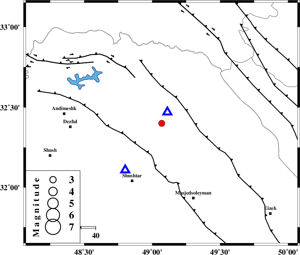
| Location | Lat:32.4 Lon: 49.07 |
| Region | Khoozestan Province, 4 km Lali |
Nearest Cities |
|
| 4 km North of Lali, Khoozestan Province | |
| 15 km North of Jaefarabad, Khoozestan Province | |
| 25 km South East of Sardasht, Khoozestan Province | |
| 30 km North of Haft shahidan, Khoozestan Province | |
| 30 km North East of Gatvand, Khoozestan Province | |
| Depth | 34 km |
| Agency | |
Faults within 150 km: |
|
| MFF2 (Length: 205 km) , Distance to epicenter: 19 km | |
| DEZFUL_EMBAYMENT (Length: 228 km) , Distance to epicenter: 22 km | |
| BALARUD_F_Z2 (Length: 58 km) , Distance to epicenter: 37 km | |
| Number of Phases | 6 |
| RMS | 0.1 |
| Number of Stations | 5 |
| Error in Latitude | >3.7 km |
| Error in Longitude | 2.7 km |
| Error in Depth | 4.3 km |
Download waveform in seisan format
to download seisan software Click here
to access information about IIEES stations Click here
Amplitude | ||||||||
| UID | Agency | Station | Component | Amplitude | Period | Arrival Time | Proccessing Time | Signal Clip |
| 95192 | IIEES | SNGE | N | 42.1 | 0.52 | 2015-03-08 03:42:10 | 2015-03-08 04:01:00 | n |
| 95193 | IIEES | SNGE | E | 47.8 | 0.52 | 2015-03-08 03:42:13 | 2015-03-08 04:01:00 | n |
Phase | ||||||||||||
| Agency | Station | Component | Phase Type | Phase Quality | First Motion | Observed Arrival Time | Time Residual | Loc. Flag | Input Weight | Distance | Azimuth | |
| IIEES | KHMZ | Z | Pg | E | 2015-03-08 03:40:50 | -0.05 | y | 170 | 29 | |||
| IIEES | ASAO | Z | Pn | E | 2015-03-08 03:41:00 | -0.04 | y | 254 | 20 | |||
| IIEES | GHVR | Z | Pn | E | 2015-03-08 03:41:06 | -0.06 | y | 307 | 41 | |||
| IIEES | GHVR | N | Sg | E | 2015-03-08 03:41:47 | 0.05 | y | 307 | 41 | |||
| IIEES | SNGE | Z | Pn | E | 2015-03-08 03:41:10 | 0.07 | y | 338 | 332 | |||
| IIEES | NASN | Z | Pn | E | 2015-03-08 03:41:12 | 0.05 | y | 354 | 82 | |||