
Magnitude |
1.8 |
| Date & Time (UTC) | 2015-03-17 18:17:15.8 |
| Date & Time (Local) | 1393/12/26 21:47:15.8 |
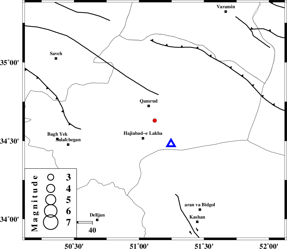
| Location | Lat:34.63 Lon: 51.12 |
| Region | Qom Province, 23 km East of Qom |
Nearest Cities |
|
| 11 km of Qamrud, Qom Province | |
| 15 km North of Hajiabad-e lakha, Qom Province | |
| 23 km East of Qom, Qom Province | |
| 36 km North East of Kahak, Qom Province | |
| 45 km North East of Yahyaabad, Esfahan Province | |
| Depth | 40 km |
| Agency | |
Faults within 150 km: |
|
| KUSHK_E_NOSRAT_F (Length: 230 km) , Distance to epicenter: 18 km | |
| INDES_F (Length: 98 km) , Distance to epicenter: 52 km | |
| SIAHKUH_F (Length: 154 km) , Distance to epicenter: 54 km | |
| Number of Phases | 4 |
| RMS | 0 |
| Number of Stations | 3 |
| Error in Latitude | >8.1 km |
| Error in Longitude | 5.4 km |
| Error in Depth | 9.2 km |
Download waveform in seisan format
to download seisan software Click here
to access information about IIEES stations Click here
Amplitude | ||||||||
| UID | Agency | Station | Component | Amplitude | Period | Arrival Time | Proccessing Time | Signal Clip |
| 95251 | IIEES | GHVR | N | 74.8 | 0.16 | 2015-03-17 18:17:29 | 2015-03-18 03:36:00 | n |
| 95252 | IIEES | DAMV | E | 18.3 | 0.12 | 2015-03-17 18:18:02 | 2015-03-18 03:36:00 | n |
Phase | ||||||||||||
| Agency | Station | Component | Phase Type | Phase Quality | First Motion | Observed Arrival Time | Time Residual | Loc. Flag | Input Weight | Distance | Azimuth | |
| IIEES | GHVR | Z | Pg | E | 2015-03-17 18:17:23 | 0 | y | 19.9 | 144 | |||
| IIEES | GHVR | E | Sg | E | 2015-03-17 18:17:28 | 0 | y | 19.9 | 144 | |||
| IIEES | ASAO | Z | Pg | E | 2015-03-17 18:17:33 | 0 | y | 101 | 265 | |||
| IIEES | DAMV | Z | Pg | E | 2015-03-17 18:17:38 | 0 | y | 136 | 35 | |||