
Magnitude |
2.5 |
| Date & Time (UTC) | 2017-04-29 10:13:29.6 |
| Date & Time (Local) | 1396/2/9 14:43:29.6 |
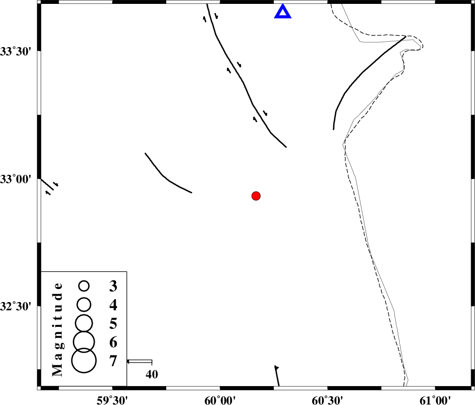
| Location | Lat:32.933 Lon: 60.167 |
| Region | Khorasan(south) Province, 49 km North-East of Sarbisheh |
Nearest Cities |
|
| 8 km of Gazik, Khorasan(south) Province | |
| 15 km North of Tabas masina, Khorasan(south) Province | |
| 27 km North East of Darmian, Khorasan(south) Province | |
| 42 km East of Asadieh, Khorasan(south) Province | |
| 45 km South East of Gasak, Khorasan(south) Province | |
| Depth | 14 km |
| Agency | |
Faults within 150 km: |
|
| ABRIZ_F (Length: 114 km) , Distance to epicenter: 25 km | |
| NOZAD_F (Length: 27 km) , Distance to epicenter: 28 km | |
| PATARGAN_F (Length: 52 km) , Distance to epicenter: 44 km | |
| Number of Phases | 4 |
| RMS | 0 |
| Number of Stations | 3 |
| Error in Latitude | >1.8 km |
| Error in Longitude | 2.1 km |
| Error in Depth | 4.1 km |
Download waveform in seisan format
to download seisan software Click here
to access information about IIEES stations Click here
Amplitude | ||||||||
| UID | Agency | Station | Component | Amplitude | Period | Arrival Time | Proccessing Time | Signal Clip |
| 115539 | IIEES | SHRT | E | 272 | 0.53 | 2017-04-29 10:13:55 | 2017-04-30 06:43:00 | n |
| 115540 | IIEES | BSRN | E | 68.3 | 0.17 | 2017-04-29 10:14:15 | 2017-04-30 06:43:00 | n |
| 115541 | IIEES | TABS | N | 13.4 | 0.39 | 2017-04-29 10:15:10 | 2017-04-30 06:43:00 | n |
Phase | ||||||||||||
| Agency | Station | Component | Phase Type | Phase Quality | First Motion | Observed Arrival Time | Time Residual | Loc. Flag | Input Weight | Distance | Azimuth | |
| IIEES | SHRT | Z | Pg | E | 2017-04-29 10:13:43 | -0.01 | y | 79.9 | 8 | |||
| IIEES | BSRN | Z | Pg | E | 2017-04-29 10:13:53 | -0.01 | y | 145 | 223 | |||
| IIEES | TABS | Z | Pn | E | 2017-04-29 10:14:14 | 0.04 | y | 295 | 286 | |||
| IIEES | TABS | N | Sg | E | 2017-04-29 10:14:52 | -0.01 | y | 295 | 286 | |||