
Magnitude |
2.7 |
| Date & Time (UTC) | 2017-10-20 19:41:04.7 |
| Date & Time (Local) | 1396/7/28 23:11:04.7 |
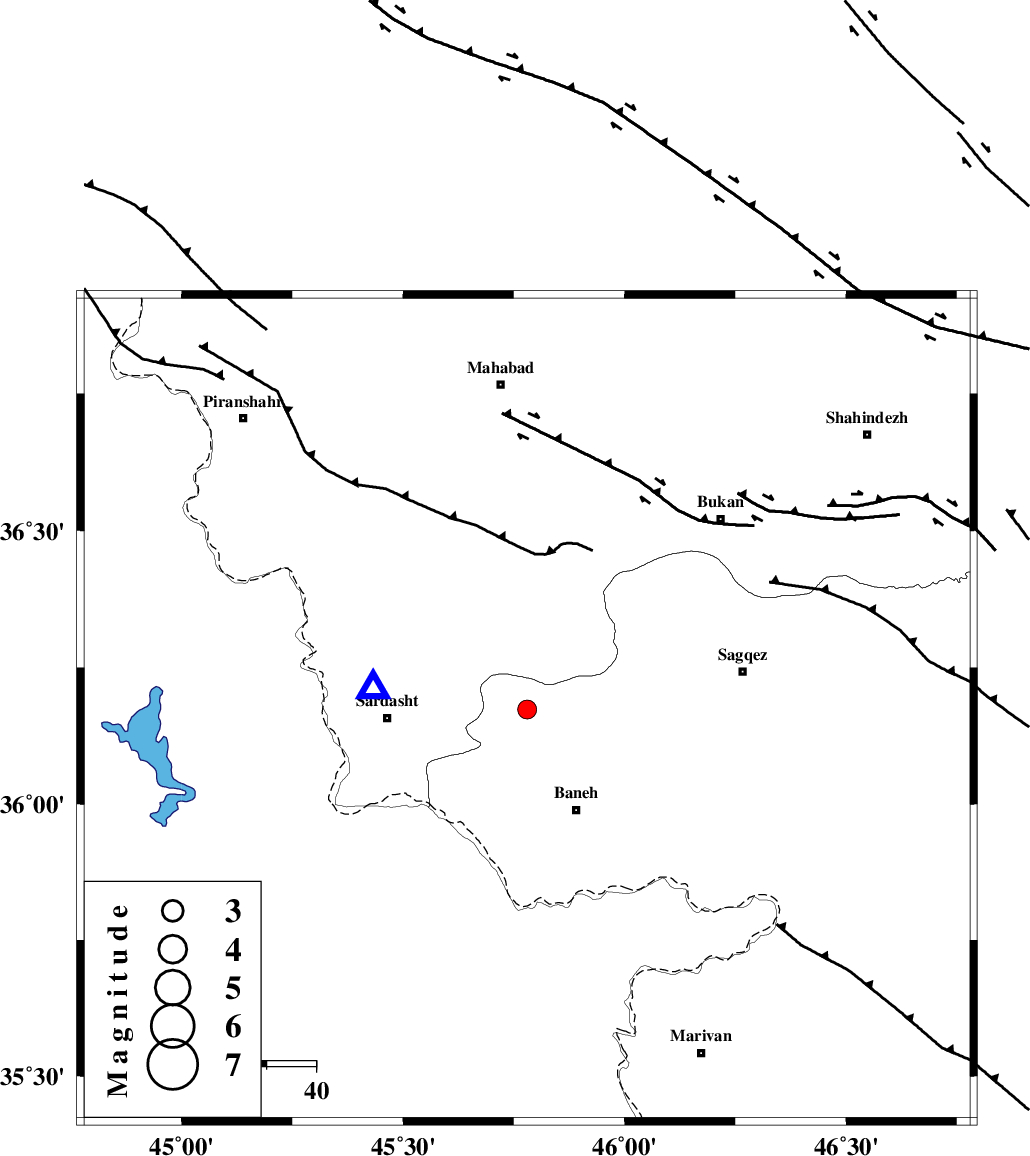
| Location | Lat:36.173 Lon: 45.78 |
| Region | Kurdistan Province, 23 km North-West of Baneh |
Nearest Cities |
|
| 7 km North of Kukhan, Kurdistan Province | |
| 10 km North of Kanisur, Kurdistan Province | |
| 17 km North of Shoy, Kurdistan Province | |
| 22 km North East of Bersiv, Azarbaijan Gharbi Province | |
| 22 km South West of Kalulan-e sofla, Azarbaijan Gharbi Province | |
| Depth | 14 km |
| Agency | |
Faults within 150 km: |
|
| PIRANSHAHR_F (Length: 253 km) , Distance to epicenter: 18 km | |
| HZF4 (Length: 492 km) , Distance to epicenter: 67 km | |
| TAKHT_E_SOLAIMAN (Length: 63 km) , Distance to epicenter: 142 km | |
| Number of Phases | 7 |
| RMS | 0.1 |
| Number of Stations | 4 |
| Error in Latitude | >1.6 km |
| Error in Longitude | 4.4 km |
| Error in Depth | 6.5 km |
Download waveform in seisan format
to download seisan software Click here
to access information about IIEES stations Click here
Amplitude | ||||||||
| UID | Agency | Station | Component | Amplitude | Period | Arrival Time | Proccessing Time | Signal Clip |
| 120582 | IIEES | SNGE | N | 62.4 | 0.67 | 2017-10-20 19:42:03 | 2017-10-21 07:13:00 | n |
| 120583 | IIEES | SNGE | E | 91.2 | 0.47 | 2017-10-20 19:42:03 | 2017-10-21 07:13:00 | n |
Phase | ||||||||||||
| Agency | Station | Component | Phase Type | Phase Quality | First Motion | Observed Arrival Time | Time Residual | Loc. Flag | Input Weight | Distance | Azimuth | |
| IIEES | SNGE | Z | Pg | E | 2017-10-20 19:41:33 | -2.27 | n | 4 | 186 | 130 | ||
| IIEES | SNGE | N | Sg | E | 2017-10-20 19:41:57 | -0.09 | y | 186 | 130 | |||
| IIEES | ZNJK | Z | Pn | E | 2017-10-20 19:41:46 | 0.27 | y | 266 | 77 | |||
| IIEES | ZNJK | N | Sg | E | 2017-10-20 19:42:20 | -0.05 | y | 266 | 77 | |||
| IIEES | GRMI | Z | Pn | E | 2017-10-20 19:41:55 | 0.02 | y | 347 | 32 | |||
| IIEES | GRMI | N | Sg | E | 2017-10-20 19:42:42 | -0.04 | y | 347 | 32 | |||
| IIEES | MAKU | Z | Pn | E | 2017-10-20 19:41:57 | -0.13 | y | 366 | 345 | |||