
Magnitude |
3.3 |
| Date & Time (UTC) | 2009-01-24 01:32:07.0 |
| Date & Time (Local) | 1387/11/5 05:02:07.0 |
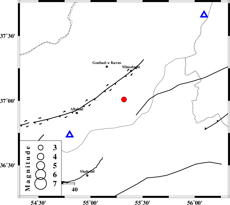
| Location | Lat:37.01 Lon: 55.32 |
| Region | 15 km East of Azadshahr, Golestan Province |
Nearest Cities |
|
| 11 km North West of Farsian, Golestan Province | |
| 12 km East of Khanduz, Golestan Province | |
| 15 km East of Azadshahr, Golestan Province | |
| 16 km East of Ramian, Golestan Province | |
| 16 km West of Qale-ye qafeh, Golestan Province | |
| Depth | 18 km |
| Agency | |
Faults within 150 km: |
|
| ROBATE_QARABIL_F (Length: 168 km) , Distance to epicenter: 17 km | |
| SHAVAR_F (Length: 87 km) , Distance to epicenter: 28 km | |
| KHAZAR_F (Length: 523 km) , Distance to epicenter: 32 km | |
| Number of Phases | 7 |
| RMS | 0.1 |
| Number of Stations | 5 |
| Error in Latitude | >4.3 km |
| Error in Longitude | 2.2 km |
| Error in Depth | 4.1 km |
Download waveform in seisan format
to download seisan software Click here
to access information about IIEES stations Click here
Amplitude | ||||||||
| UID | Agency | Station | Component | Amplitude | Period | Arrival Time | Proccessing Time | Signal Clip |
| 51744 | IIEES | DAMV | E | 49.5 | 0.44 | 2009-01-24 01:33:47 | 2009-06-27 08:52:00 | n |
| 51745 | IIEES | THKV | N | 60.9 | 0.6 | 2009-01-24 01:34:09 | 2009-06-27 08:52:00 | n |
| 51746 | IIEES | THKV | E | 74.1 | 0.6 | 2009-01-24 01:34:09 | 2009-06-27 08:52:00 | n |
Phase | ||||||||||||
| Agency | Station | Component | Phase Type | Phase Quality | First Motion | Observed Arrival Time | Time Residual | Loc. Flag | Input Weight | Distance | Azimuth | |
| IIEES | BJRD | Z | Pg | E | 2009-01-24 01:32:39 | 0 | y | 200 | 67 | |||
| IIEES | BJRD | E | Sg | E | 2009-01-24 01:33:04 | 0.1 | y | 200 | 67 | |||
| IIEES | DAMV | Z | Pn | E | 2009-01-24 01:32:56 | -0.1 | y | 338 | 244 | |||
| IIEES | DAMV | E | Sg | E | 2009-01-24 01:33:41 | 0.1 | y | 338 | 244 | |||
| IIEES | CHTH | Z | Pn | E | 2009-01-24 01:33:03 | -0.2 | y | 395 | 253 | |||
| IIEES | TABS | Z | Pn | E | 2009-01-24 01:33:04 | 0 | y | 407 | 156 | |||
| IIEES | THKV | N | Sg | E | 2009-01-24 01:34:03 | 0.2 | y | 416 | 254 | |||