
Magnitude |
2.9 |
| Date & Time (UTC) | 2009-12-08 17:26:29.8 |
| Date & Time (Local) | 1388/9/17 20:56:29.8 |
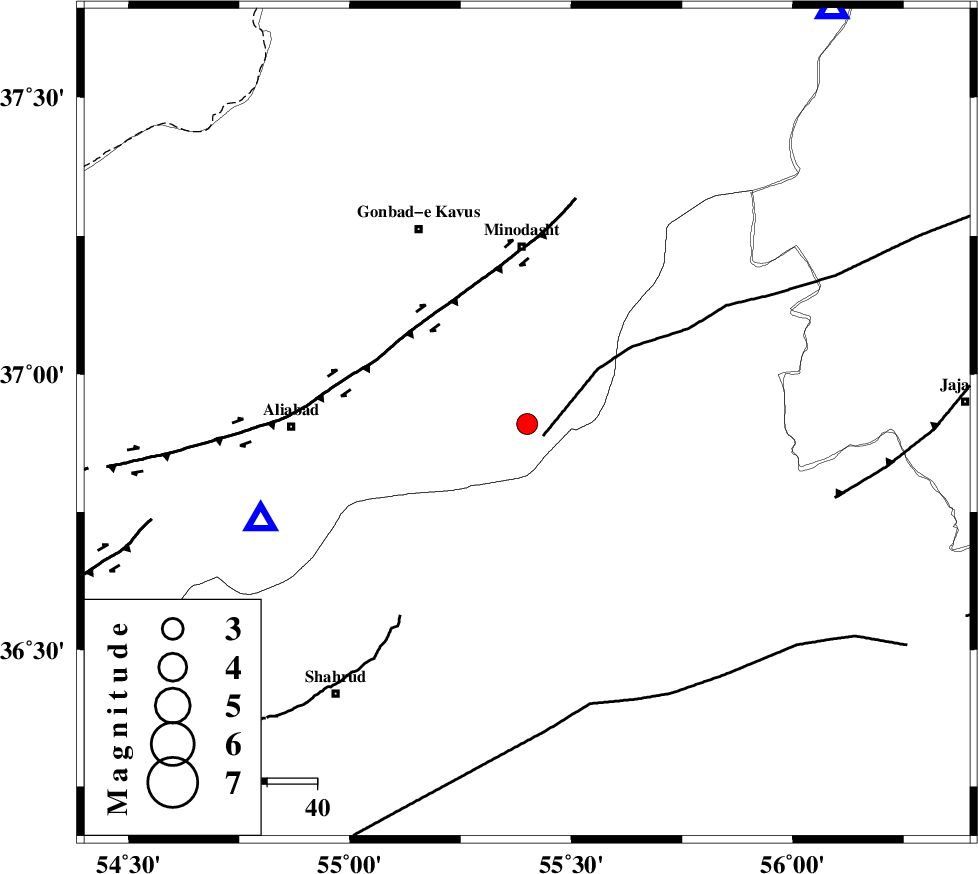
| Location | Lat:36.91 Lon: 55.4 |
| Region | Golestan Province, 35 km South of Minodasht |
Nearest Cities |
|
| 5 km of Farsian, Golestan Province | |
| 17 km South of Qale-ye qafeh, Golestan Province | |
| 23 km West of Qaleh qafeh, Semnan Province | |
| 24 km South East of Khanduz, Golestan Province | |
| 25 km South East of Ramian, Golestan Province | |
| Depth | 46 km |
| Agency | |
Faults within 150 km: |
|
| ROBATE_QARABIL_F (Length: 168 km) , Distance to epicenter: 4 km | |
| SHAVAR_F (Length: 87 km) , Distance to epicenter: 23 km | |
| KHAZAR_F (Length: 523 km) , Distance to epicenter: 40 km | |
| Number of Phases | 4 |
| RMS | 0 |
| Number of Stations | 3 |
| Error in Latitude | >8.8 km |
| Error in Longitude | 16.9 km |
| Error in Depth | 23 km |
Download waveform in seisan format
to download seisan software Click here
to access information about IIEES stations Click here
Amplitude | ||||||||
| UID | Agency | Station | Component | Amplitude | Period | Arrival Time | Proccessing Time | Signal Clip |
| 59664 | IIEES | BJRD | N | 114.4 | 0.29 | 2009-12-08 17:27:29 | 2010-02-08 11:55:00 | n |
| 59665 | IIEES | BJRD | E | 96.5 | 0.19 | 2009-12-08 17:27:31 | 2010-02-08 11:55:00 | n |
| 59666 | IIEES | DAMV | E | 42 | 0.39 | 2009-12-08 17:28:12 | 2010-02-08 11:55:00 | n |
| 59667 | IIEES | DAMV | N | 42.4 | 1.05 | 2009-12-08 17:28:13 | 2010-02-08 11:55:00 | n |
Phase | ||||||||||||
| Agency | Station | Component | Phase Type | Phase Quality | First Motion | Observed Arrival Time | Time Residual | Loc. Flag | Input Weight | Distance | Azimuth | |
| IIEES | SHRO | Z | Pg | E | 2009-12-08 17:26:49 | 0 | y | 115 | 151 | |||
| IIEES | BJRD | Z | Pg | E | 2009-12-08 17:27:02 | 0 | y | 198 | 63 | |||
| IIEES | BJRD | N | Sg | E | 2009-12-08 17:27:25 | 0 | y | 198 | 63 | |||
| IIEES | DAMV | Z | Pn | E | 2009-12-08 17:27:16 | 0 | y | 339 | 246 | |||