
Magnitude |
2.8 |
| Date & Time (UTC) | 2010-07-19 07:20:41.1 |
| Date & Time (Local) | 1389/4/28 11:50:41.1 |
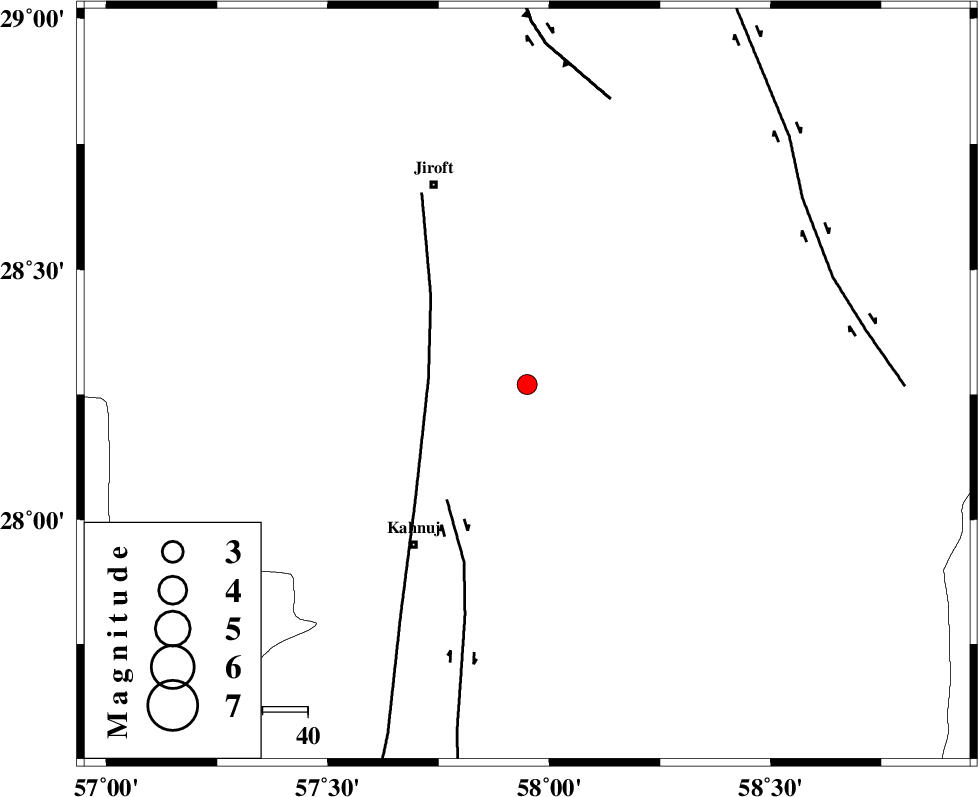
| Location | Lat:28.27 Lon: 57.95 |
| Region | Kerman Province, 43 km North-East of Kahnuj |
Nearest Cities |
|
| 17 km South of Dosari, Kerman Province | |
| 20 km South of Aliabad-e qadiri, Kerman Province | |
| 24 km West of Mardehak, Kerman Province | |
| 28 km South East of Khesrabad, Kerman Province | |
| 37 km South West of Dahane-ye gomrokan, Kerman Province | |
| Depth | 15 km |
| Agency | |
Faults within 150 km: |
|
| SABZEVARAN_F (Length: 190 km) , Distance to epicenter: 22 km | |
| JIROFT_F (Length: 144 km) , Distance to epicenter: 31 km | |
| GOWK_F (Length: 152 km) , Distance to epicenter: 66 km | |
| Number of Phases | 3 |
| RMS | 0 |
| Number of Stations | 3 |
| Error in Latitude | >2.1 km |
| Error in Longitude | 2 km |
| Error in Depth | 0 km |
Download waveform in seisan format
to download seisan software Click here
to access information about IIEES stations Click here
Amplitude | ||||||||
| UID | Agency | Station | Component | Amplitude | Period | Arrival Time | Proccessing Time | Signal Clip |
| 66190 | IIEES | BNDS | N | 143.8 | 0.18 | 2010-07-19 07:21:39 | 2010-07-20 01:47:00 | n |
| 66191 | IIEES | KRBR | N | 41.6 | 0.37 | 2010-07-19 07:21:48 | 2010-07-20 01:47:00 | n |
Phase | ||||||||||||
| Agency | Station | Component | Phase Type | Phase Quality | First Motion | Observed Arrival Time | Time Residual | Loc. Flag | Input Weight | Distance | Azimuth | |
| IIEES | BNDS | Z | Pg | E | 2010-07-19 07:21:13 | 0 | y | 200 | 242 | |||
| IIEES | KRBR | Z | Pg | E | 2010-07-19 07:21:17 | 0 | y | 222 | 329 | |||
| IIEES | ZHSF | Z | Pn | E | 2010-07-19 07:21:27 | 0 | y | 313 | 61 | |||