
Magnitude |
3.8 |
| Date & Time (UTC) | 2011-06-04 11:26:18.6 |
| Date & Time (Local) | 1390/3/14 15:56:18.6 |
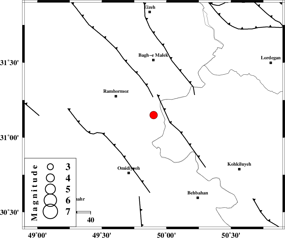
| Location | Lat:31.15 Lon: 49.9 |
| Region | Khoozestan Province, 41 km South of Bagh Malek |
Nearest Cities |
|
| 19 km South of Dalan, Khoozestan Province | |
| 22 km North East of Soltanabad, Khoozestan Province | |
| 29 km South West of Seidun, Khoozestan Province | |
| 31 km North of Jayzan, Khoozestan Province | |
| 31 km South East of Ramhormoz, Khoozestan Province | |
| Depth | 18 km |
| Agency | |
Faults within 150 km: |
|
| MFF4 (Length: 62 km) , Distance to epicenter: 13 km | |
| DEZFUL_EMBAYMENT (Length: 228 km) , Distance to epicenter: 13 km | |
| MFF2 (Length: 205 km) , Distance to epicenter: 34 km | |
| Number of Phases | 5 |
| RMS | 0.1 |
| Number of Stations | 5 |
| Error in Latitude | >6.7 km |
| Error in Longitude | 6.6 km |
| Error in Depth | 10.6 km |
Download waveform in seisan format
to download seisan software Click here
to access information about IIEES stations Click here
Amplitude | ||||||||
| UID | Agency | Station | Component | Amplitude | Period | Arrival Time | Proccessing Time | Signal Clip |
| 79214 | IIEES | SHGR | N | 4247.4 | 0.71 | 2011-06-04 11:27:03 | 2011-06-04 11:56:00 | n |
| 79215 | IIEES | SHGR | E | 3976.5 | 0.47 | 2011-06-04 11:27:03 | 2011-06-04 11:56:00 | n |
| 79216 | IIEES | KHMZ | E | 270.9 | 0.53 | 2011-06-04 11:27:44 | 2011-06-04 11:56:00 | n |
| 79217 | IIEES | ASAO | E | 140.5 | 1.13 | 2011-06-04 11:28:15 | 2011-06-04 11:56:00 | n |
| 79218 | IIEES | GHVR | E | 77.4 | 1.14 | 2011-06-04 11:28:12 | 2011-06-04 11:56:00 | n |
| 79219 | IIEES | SNGE | N | 101.1 | 0.58 | 2011-06-04 11:28:21 | 2011-06-04 11:56:00 | n |
| 79220 | IIEES | SNGE | E | 77.5 | 0.69 | 2011-06-04 11:28:21 | 2011-06-04 11:56:00 | n |
Phase | ||||||||||||
| Agency | Station | Component | Phase Type | Phase Quality | First Motion | Observed Arrival Time | Time Residual | Loc. Flag | Input Weight | Distance | Azimuth | |
| IIEES | SHGR | Z | Pg | E | 2011-06-04 11:26:43 | 0.1 | y | 149 | 316 | |||
| IIEES | SHGR | E | Sg | E | 2011-06-04 11:27:01 | -0.1 | y | 149 | 316 | |||
| IIEES | KHMZ | Z | Pn | E | 2011-06-04 11:27:01 | 0.1 | y | 288 | 1 | |||
| IIEES | KHMZ | E | Sg | E | 2011-06-04 11:27:39 | 0 | y | 288 | 1 | |||
| IIEES | ASAO | Z | Pn | E | 2011-06-04 11:27:12 | -0.2 | y | 377 | 2 | |||