
Magnitude |
3.8 |
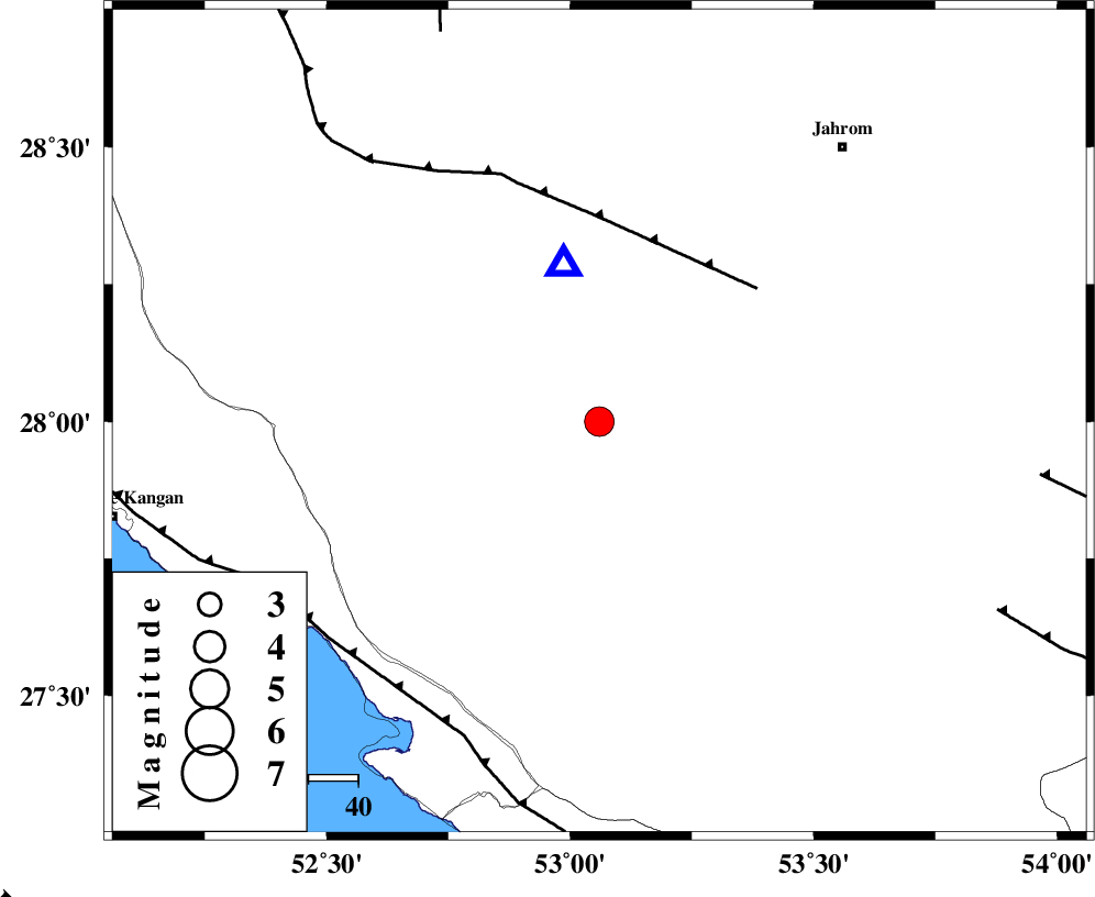
| Date & Time (UTC) | 2012-01-06 13:16:21.6 |
| Date & Time (Local) | 1390/10/16 16:46:21.6 |
| Location | Lat:28 Lon: 53.06 |
| Region | Fars Province, 52 km South of Qir va Karzin |
Nearest Cities |
|
| 20 km South of Seyfabad, Fars Province | |
| 33 km East of Garmesht, Fars Province | |
| 38 km North West of Khonj, Fars Province | |
| 43 km North of Alamarvdasht, Fars Province | |
| 46 km South of Shahrak-e jonubi, Fars Province | |
| Depth | 14 km |
| Agency | |
Faults within 150 km: |
|
| QIR_F (Length: 130 km) , Distance to epicenter: 42 km | |
| MFF3 (Length: 292 km) , Distance to epicenter: 69 km | |
| SABZ_PUSHAN_F_Z1 (Length: 69 km) , Distance to epicenter: 85 km | |
| Number of Phases | 5 |
| RMS | 0.1 |
| Number of Stations | 5 |
| Error in Latitude | >4.7 km |
| Error in Longitude | 3.6 km |
| Error in Depth | 4.5 km |
Download waveform in seisan format
to download seisan software Click here
to access information about IIEES stations Click here
Amplitude | ||||||||
| UID | Agency | Station | Component | Amplitude | Period | Arrival Time | Proccessing Time | Signal Clip |
| 81266 | IIEES | AHRM | N | 544.6 | 0.64 | 2012-01-06 13:17:31 | 2012-01-06 04:55:00 | n |
| 81267 | IIEES | BNDS | E | 361.5 | 0.48 | 2012-01-06 13:18:03 | 2012-01-06 04:55:00 | n |
| 81268 | IIEES | BNDS | N | 424.9 | 0.52 | 2012-01-06 13:18:05 | 2012-01-06 04:55:00 | n |
| 81269 | IIEES | KRBR | E | 155.6 | 0.6 | 2012-01-06 13:18:47 | 2012-01-06 04:55:00 | n |
Phase | ||||||||||||
| Agency | Station | Component | Phase Type | Phase Quality | First Motion | Observed Arrival Time | Time Residual | Loc. Flag | Input Weight | Distance | Azimuth | |
| IIEES | GHIR | Z | Pg | E | 2012-01-06 13:16:27 | 0.06 | y | 32.5 | 347 | |||
| IIEES | AHRM | Z | Pg | E | 2012-01-06 13:16:55 | -0.08 | y | 198 | 299 | |||
| IIEES | BNDS | Z | Pn | E | 2012-01-06 13:17:08 | -0.08 | y | 314 | 102 | |||
| IIEES | KRBR | Z | Pn | E | 2012-01-06 13:17:22 | 0.26 | y | 422 | 58 | |||
| IIEES | NASN | Z | Pn | E | 2012-01-06 13:17:35 | -0.17 | y | 533 | 357 | |||