| Prel. Rep. | Date | Time(UTC) | Time(Local) | Lat. | Lon. | Depth | Mag. | Region | Waveform |
|
|
2012/01/06
|
13:16:21.6
|
16:46:21.6
| 28 | 53.06 | 14 |
ML:3.8
|
Fars Province, 52 km South of Qir va Karzin | |
|
|
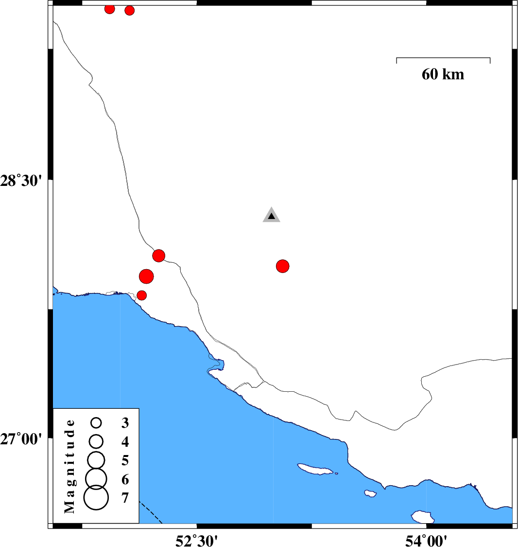
2012/01/05
|
21:42:01.2
|
01:12:01.2
| 27.83 | 52.14 | 40 |
ML:2.8
|
Bushehr Province, 7 km Bandar-e kangan | |
|
|
2012/01/05
|
17:49:11.2
|
21:19:11.2
| 28.06 | 52.25 | 42 |
ML:3.6
|
Bushehr Province, 26 km North of Jam | |
|
|
2012/01/05
|
16:53:38.5
|
20:23:38.5
| 27.94 | 52.17 | 38 |
ML:4.3
|
Bushehr Province, 17 km North-East of Bandar-e kangan | |
|
|
2011/12/30
|
01:04:06.6
|
04:34:06.6
| 29.47 | 52.06 | 41 |
ML:2.8
|
Fars Province, 42 km South-East of Kazerun | |
|
|
2011/12/30
|
01:00:55.2
|
04:30:55.2
| 29.48 | 51.93 | 43 |
ML:2.9
|
Fars Province, 31 km South-East of Kazerun | |